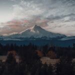
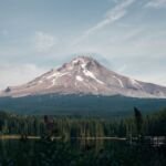
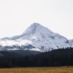
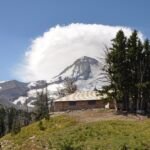
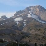
The Mount Hood Wilderness protects the upper mountain: its glaciers, alpine meadows and most of the trail that circles the peak. Congress created it on September 3, 1964, in the Wilderness Act, the law that set up the National Wilderness Preservation System. It started at about 14,160 acres. Congress enlarged it in 1978 and again in 2009, and Wilderness Connect now lists it at 64,742 acres.
The idea of keeping the high country wild is older than the law. The Forest Service had already set the area aside by its own decision in 1930, and two later acts added land around its edges.
Before the Wilderness Act
By the early 1930s the Forest Service had set aside a number of primitive areas across the West. A 1938 National Park Service report on recreation lands lists a Mount Hood primitive area of about 14,800 acres, approved by the Forester in October 1930. That protection came from agency policy, not from Congress.
The Wilderness Act changed the footing. Section 3(a) took every national forest area that the Forest Service or the agriculture secretary had classed as wilderness, wild or canoe country at least 30 days before the act and made it wilderness by law. The Mount Hood Wilderness was one of these; later laws describe it as designated under that section. Its first boundary held about 14,160 acres around the summit and upper slopes.
The act also gave the idea a definition. It describes wilderness as a place “where man himself is a visitor who does not remain,” with no permanent improvements or anyone living there, and managed so its natural conditions last.
The 1978 additions
The first expansion came with the Endangered American Wilderness Act, signed February 24, 1978. Section 3(d) folded about 33,000 acres of proposed additions, mapped under the Zig Zag name, into the Mount Hood Wilderness. The addition more than tripled its size.
The 2009 law
The second expansion came three decades later in the Omnibus Public Land Management Act, signed March 30, 2009. Its Mt. Hood subtitle created what it calls the Lewis and Clark Mount Hood Wilderness Areas. For the Mount Hood Wilderness, that meant about 18,450 new acres in pieces mapped as Barlow Butte, Elk Cove and Mazama, Sand Canyon, the Sandy additions, Twin Lakes, White River and Cloud Cap, along with the Richard L. Kohnstamm Memorial Area. The law set aside another 1,710 acres at Tilly Jane to join once a land exchange was finished. Wilderness Connect counts the 2009 additions as about 20,160 acres.
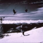
The Kohnstamm area honors Richard L. Kohnstamm, whose company has run Timberline Lodge since 1955. Timberline describes it as a 126-acre parcel above the Palmer chairlift.
The same law reached well beyond the mountain. It created the Roaring River and Lower White River wildernesses and the Clackamas Wilderness, enlarged others across the forest, protected new wild and scenic river segments, and established a Mount Hood National Recreation Area of about 34,550 acres. The Forest Service counts more than 124,000 acres of the forest’s wilderness as designated in 2009.
Why the totals differ
Add up the acreage named in the three laws and you get about 67,320 acres, more than the official 64,742. Wilderness Connect explains the gap in general terms. The figure written into a bill is a first estimate made while the boundary is being drafted. The official number comes later from the managing agency, once boundaries are settled and measured with mapping software, and Forest Service totals leave out private inholdings.
See it today
The Timberline Trail loops about 38 miles around the mountain, and many side trails climb through the wilderness to meet it.
- North side: the Elk Cove Trail and Mazama Trail climb toward the Elk Cove and Mazama country named in the 2009 law. Start at Elk Cove Trailhead or Mazama Trailhead.
- Northeast side: the Cloud Cap Trailhead and the Tilly Jane Trail lead into the Cloud Cap and Tilly Jane areas.
- South side: the Timberline Lodge trailheads reach the Timberline Trail; the Kohnstamm area lies higher, above the Palmer lift.
- Newer neighbors: the 2009 law also created the Lower White River Wilderness and Roaring River Wilderness.
For permits, group limits and current rules, read our Mount Hood Wilderness guide and Leave No Trace page before you go.