
Lava flows begin stacking up the broad base of today's mountain, on a site where earlier volcanoes had risen for more than a million years.
Read the full storyA giant landslide carries off the summit and north flank. Its lahar runs some 400 feet deep at today's Hood River, then crosses the Columbia into Washington.
In the Polallie eruptive period, lava domes push up near the top and build much of the summit seen today, including Steel Cliff.
Read the full storyEarly in the Timberline period, a landslide carves the open crater on the south side. Later flows lay down the smooth slope under Timberline Lodge and Government Camp.
Read the full storyThe Molalla, Cascades, Kalapuya, Clackamas, Klickitat, Wasco and other peoples hunt the mountain's slopes, fish its rivers and give names to its places.
A lava dome grows where Crater Rock stands and keeps crumbling for a decade or more, sending lahars down the Sandy and White rivers.
Read the full storyLt. William Broughton of the Vancouver expedition sights the peak from the Columbia River and names it for Admiral Lord Samuel Hood.
Read the full storyLewis and Clark see the mountain and call the Sandy River the Quicksand River. It was still clogged with sand washed down from the Old Maid eruptions.
Read the full storyAfter a grueling 1845 trek around the mountain, Samuel Barlow opens a toll road at $5 a wagon, giving Oregon Trail families a way over the Cascades by land.
Read the full storyCaught by an early storm, a unit of U.S. Mounted Rifles leaves about 45 wagons on Camp Creek. The spot becomes known as Government Camp.
Read the full storyOregonian editor Thomas Dryer claims the first ascent, and his report puts the peak at 18,361 feet, over 7,000 feet too high. Historians think he stopped a few hundred feet short.
Read the full storyTreaties negotiated by Oregon superintendent Joel Palmer take most tribal land around the mountain, and many western Oregon bands are later removed to Grand Ronde. The Warm Springs and Wasco keep their rights to fish, hunt and gather off the reservation.
On July 11, a party that includes Henry Pittock reaches the top. Most historians count it as the first ascent.
Read the full storySettlers report fire, smoke and flying rock on the summit in 1859 and 1865, and newspapers note smoke in 1866. Geologists have found no deposits that tie to these events.
Read the full storyA log inn opens high on the north side, near Eliot Glacier. Its first guests show up in August, before the building is quite finished.
Read the full storyPresident Benjamin Harrison sets aside the Bull Run watershed as a forest reserve. In 1893 the Cascade Range Forest Reserve takes in the mountain itself.
Three men make it to the snowed-in Cloud Cap Inn on heavy wooden skis, pushing along with long poles. It is the first skiing on the mountain in the Mazamas' records.
Read the full storyThe reserves are reorganized, and the land around the mountain becomes the Oregon National Forest. It is renamed Mt. Hood National Forest in 1924.
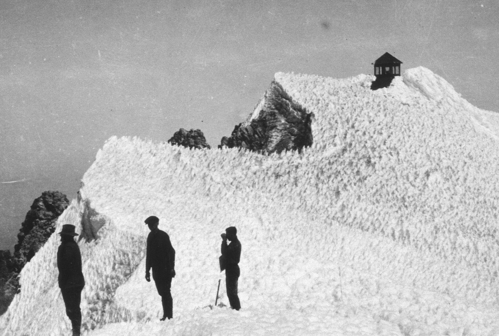
A 12-by-12-foot fire lookout cabin goes up on the summit and becomes the model for lookouts across the region. Abandoned in 1935, it slid off the peak in 1941.
Read the full storyOn June 30, a caravan drives the first full 173-mile loop around the mountain in eight hours. That same year, road crews come across the Pioneer Woman's Grave near Barlow Pass.
Read the full storyPresident Franklin D. Roosevelt dedicates the WPA-built lodge on September 28. Workers forged its andirons from old railroad rails and made hooked rugs from scraps, including castoff CCC uniforms and blankets.
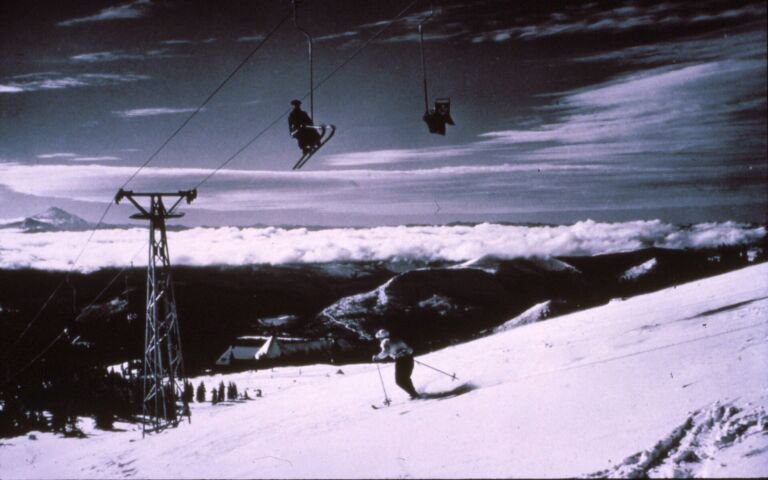
Read the full storyOne of the country's first chairlifts starts running in falling snow on November 26. Riders got seat belts and blankets, and Norway's crown prince and princess had bolted the first tower in place that May.
Read the full storyThe Wilderness Act protects the mountain's upper slopes as the Mount Hood Wilderness. Congress enlarges it in 1978 and again in 2009.
Read the full storySeven students and two adults from Oregon Episcopal School die after a severe storm traps their climbing group high on the mountain. The school honors them every May.
A magnitude 4.5 earthquake, the largest recorded near Mt. Hood, is widely felt. More than 200 smaller quakes follow over the next seven weeks.
USGS scientists sample the gas vents at Crater Rock every year and track small quakes from nearby stations. The Forest Service consults three tribal nations on how the land is cared for.
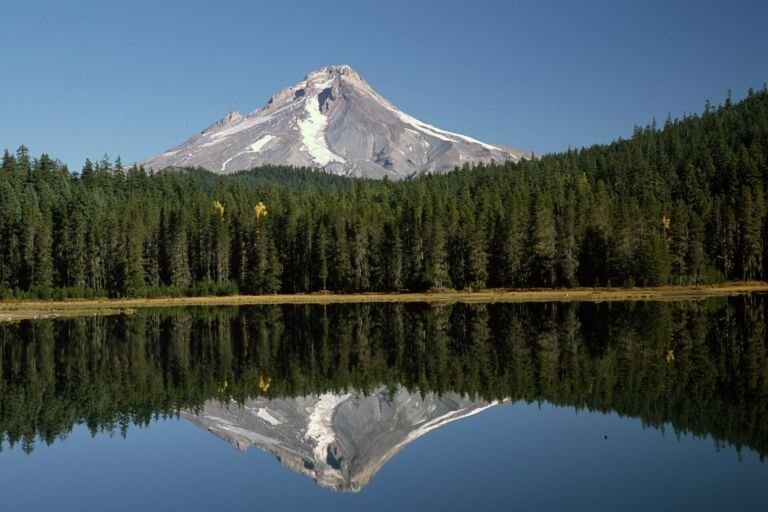
Read the full storyMt. Hood is a stratovolcano made of andesite and dacite lava. It sits above the spot where the Juan de Fuca Plate dives beneath North America, the same process behind the other Cascade volcanoes. The mountain you see has grown in fits and starts for at least half a million years, with busy spells of decades or centuries and quiet gaps that sometimes ran past 10,000 years.
For the past 30,000 years, most eruptions have followed one pattern. Thick lava domes pile up near the summit, then crumble into hot avalanches of rock and gas. Those flows melt snow and ice into lahars, fast slurries of mud and boulders that can run far down the river valleys.
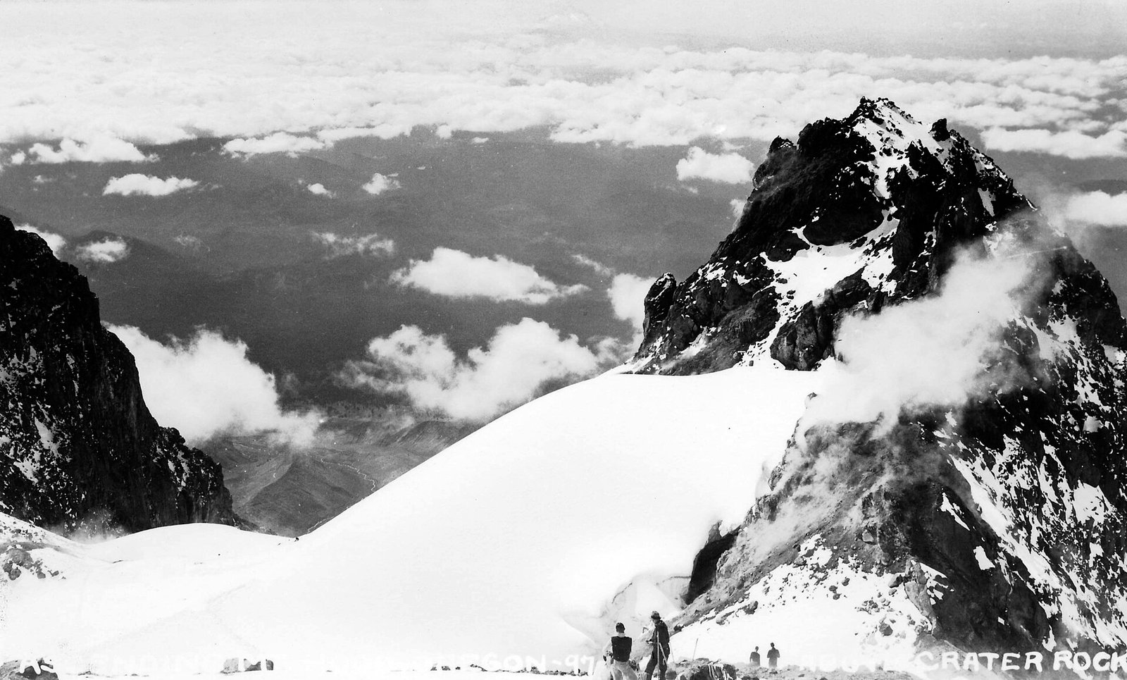
Domes grew during and just after the last ice age and built much of today's summit, including Steel Cliff.
A landslide opened the south side crater, and the flows that followed built the smooth slope under Timberline Lodge.
A smaller period that left deposits in the Zigzag and upper Sandy river valleys.
A dome grew and collapsed for a decade or more. Crater Rock, below the summit on the south side, is what remains of it.
Is Mt. Hood still active? Yes, though it is not erupting. Vents near Crater Rock still give off steam and a rotten-egg smell, and it is Oregon's most seismically active volcano, with one or two small quakes near the summit in a typical month. The USGS Cascades Volcano Observatory and the Pacific Northwest Seismic Network track it with five seismic stations within 12 miles, and scientists sample its gases every year.
Scientists expect a future eruption to look a lot like Old Maid, with growing domes and lahars, and they rank lahars in the Sandy and White River valleys as the biggest concern. Lahars can happen without an eruption, too. On Christmas Day 1980, a rain-triggered lahar in Polallie Creek killed a camper and wrecked five miles of highway. For current status, see the USGS links at the bottom of this page.
Long before the mountain had an English name, it stood at the heart of Native homelands. The National Park Service lists the Molalla, Cascades, Kalapuya, Clackamas, Klickitat and Wasco among the peoples who hunted here, fished the rivers and named its sacred places. A Native trail over Lolo Pass skirted the mountain's northwest side, and Samuel Barlow's 1845 party camped near a Tygh village east of the mountain.
The best-known story about the mountain is a Klickitat telling, as retold by the National Park Service: Wy'east was a proud man whom the Creator turned into a mountain after he fought his brother over a woman. The name Wy'east is everywhere around Portland today, but its origin is in doubt. Henry Zenk, a linguist who works with the Confederated Tribes of Grand Ronde, told the tribe's newspaper that "the weight of evidence is against Wy'east as a genuine Tribal name." As the Forest Service puts it, each people had its own names for the mountain.
Treaties signed in 1855 took most of this land from the tribes. Under the Willamette Valley Treaty, the Clackamas, Cascades, Multnomah and other bands gave up their homelands and were later removed to the Grand Ronde Reservation. In the Treaty with the Tribes of Middle Oregon, the Warm Springs and Wasco ceded about 10 million acres but kept the right to fish, hunt and gather at their usual places.

The Confederated Tribes of Warm Springs unite the Warm Springs, Wasco and Paiute peoples on a reservation east of the Cascades.
More than 30 tribes and bands of western Oregon, including the Clackamas and Molalla, belong to the Confederated Tribes of Grand Ronde.
The Confederated Tribes of Siletz Indians also have ancestral ties to the forest, according to the Forest Service.
The Forest consults all three nations on its projects, under agreements that cover berries, roots, access and more.
In late October 1792, a British survey party led by Lt. William Broughton, part of Capt. George Vancouver's expedition, sighted the peak from the Columbia River. Broughton named it for Lord Samuel Hood, an admiral of the Royal Navy.
Lewis and Clark spotted it in October 1805 on their way down the Columbia. Near The Dalles, Clark called it "Timm or falls Mountain," according to the National Park Service, and by their 1806 return trip the captains were using the name Mount Hood. They called the Sandy River the Quicksand River, because it was still choked with sand from the Old Maid eruptions, which had ended about a decade earlier.
Climbers soon followed. Joel Palmer, scouting the Barlow route in 1845, made it to just above Illumination Rock. In 1854, Oregonian editor Thomas Dryer said he had reached the top, but historians think he fell a few hundred feet short. Most credit the first ascent to a party that included Henry Pittock, on July 11, 1857.

For Oregon Trail families, the Cascades were the last wall before the Willamette Valley. Before 1846, wagons had to go down the Columbia from The Dalles by boat, often after a long and costly wait. In the fall of 1845, Samuel Barlow decided to cut a road around the south side of Mt. Hood instead. Snow and rain forced his party and Joel Palmer's to stash their wagons and walk out, and they reached Philip Foster's farm on December 23. Everyone survived.
In 1846 Barlow opened the route as a toll road, charging $5 a wagon plus 10 cents for each head of stock. About a thousand emigrants and 152 wagons came over it that first season, and most later travelers chose it over the river despite grumbling about tolls and ruts. The last tolls were taken by 1919, when the road's final owners deeded it to the state, and parts of the route became the Mt. Hood Loop Highway.
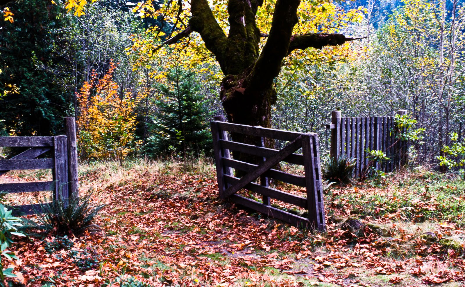
The hardest descent on the Oregon Trail. Families locked wheels, dragged logs and lowered wagons down a 60 percent grade.
The road's high point at 4,160 feet, where the Pacific Crest Trail now crosses it.
Highway builders found this forgotten grave of an unknown emigrant woman in 1924.
Named for an 1849 Army unit that abandoned its wagons on Camp Creek in an early storm.
Tourism started on the north side. In 1889, Portland's William M. Ladd and C.E.S. Wood opened Cloud Cap Inn, a log lodge near Eliot Glacier, along with a stage road that Chinese laborers graded by hand. Guests rode a stage for five to six hours from the train at Hood River, and Sarah Langille ran the inn for 16 years. In February 1897, three men reached it on wooden skis, the first skiing on the mountain in the Mazamas' records.
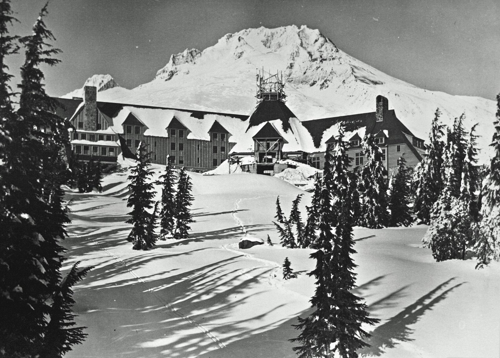
The Great Depression moved the action south. Crews paid by the Works Progress Administration built Timberline Lodge at about 6,000 feet, by hand, from Oregon stone and timber. President Franklin D. Roosevelt dedicated it on September 28, 1937, and it opened to guests on February 4, 1938. Every guest room got its own design, and the central chimney rises 92 feet over six fireplaces.
The north side's early resort, long looked after by the Crag Rats, a mountain rescue club from Hood River.
Now Timberline's Summit Pass, which Timberline calls the Pacific Northwest's oldest ski area.
A WPA showpiece and a National Historic Landmark since 1977.
Its National Register record calls it the second chairlift built in the country and the first on steel towers.
Portland's drinking water started the effort to protect Mt. Hood. In 1892, President Benjamin Harrison set aside the Bull Run watershed as a forest reserve, and the city began using its water in 1895. In 1893, President Grover Cleveland set aside the Cascade Range Forest Reserve, about 5 million acres that took in the mountain.
In 1908 the reserves were divided, and this one became the Oregon National Forest. It took the name Mt. Hood National Forest in 1924. Today the forest covers about 1.1 million acres, and its watersheds supply water to about a third of Oregonians.
The Wilderness Act of 1964 protected the upper mountain as the Mount Hood Wilderness, and Congress added to it in 1978 and 2009. The 2009 law designated more than 124,000 acres of new wilderness across the forest. That year Congress also set aside 126 acres above the Palmer lift in honor of longtime Timberline operator Richard L. Kohnstamm.

Portland's water source, still under special protection.
First the Oregon National Forest, renamed for the mountain in 1924.
The upper slopes, glaciers and the Timberline Trail.
Larger wilderness on the mountain and across the forest.
The busiest summit routes start at Timberline Lodge and climb the south side past Crater Rock and the Hogsback, a gain of more than 5,000 feet. Even these are technical climbs, with crevasses, falling ice and rock, and weather that can turn fast. There is no hiking trail to the top.
Group climbs have a long history here. From 1921 until 1953, a Hood River American Legion post led yearly climbs up the Cooper Spur route that drew hundreds of people, with no serious accident in all those years, according to the National Register record. The mountain has also seen loss. In May 1986, a climbing group from Portland's Oregon Episcopal School was caught by a severe storm high on the mountain. Seven students and two adults died, and more than 150 people joined the search. The school gathers every May to remember them.
Thinking about a climb? Start with the Forest Service's climbing page and the climbing rangers' conditions reports. As of 2026, you need a Mt. Hood Climbing Permit for any travel above 9,500 feet, and the Forest Service treats crampons, an ice axe and a helmet as basic gear. Rules and conditions change, so check before you go, and read our trail safety guide.
 Pioneer Woman's Grave TrailWalk a stretch of the old Barlow Road below Barlow Pass to the grave found by highway crews in 1924.Read the guide
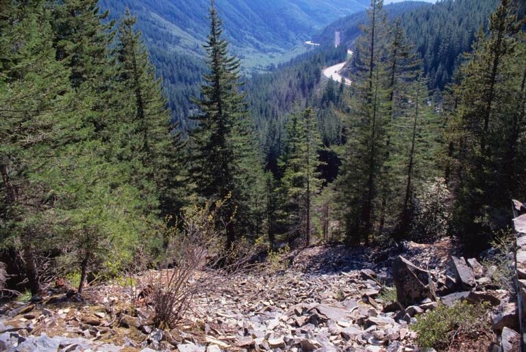 Laurel Hill ChuteA short loop off US 26 to the rocky chute where emigrants lowered their wagons.Read the guide
 Historic sitesBrowse historic places around the mountain, from Oregon Trail sites to old lodges.Read the guide
 Mount Hood WildernessPermits, group limits and the best trails into the glaciers and meadows of the upper mountain.Read the guide
 Timberline Lodge weatherCheck the forecast at the lodge before you head up the mountain.Read the guide
 Leave No TraceSimple habits that keep these historic places and wild slopes in good shape.Read the guide
The U.S. Geological Survey lists Mt. Hood at 11,240 feet (3,426 meters), the highest point in Oregon. You will see slightly different figures, such as 11,239 or 11,245 feet, depending on the survey and the year. Early guesses were far off: an 1854 newspaper account put it at 18,361 feet.
Its last major eruptive period, called Old Maid, began around 1781 and lasted a decade or more. Settlers reported smaller outbursts of fire, smoke and steam in 1859 and 1865, but geologists have not found deposits tied to those reports. The mountain has been quiet since the mid-1800s.
Yes. The USGS considers it active, and steam vents near Crater Rock show there is still heat below. It is not erupting now. The USGS Cascades Volcano Observatory and the Pacific Northwest Seismic Network monitor its earthquakes and gases, and the USGS posts updates on its Mount Hood page.
The Forest Service counts 11 active glaciers. The largest, Eliot and Coe on the north side, are each about 1.5 to 1.8 miles long. The Palmer area above Timberline Lodge is a snowfield, not a glacier, even though some maps label it one.
Lord Samuel Hood, an admiral in Britain's Royal Navy. Lt. William Broughton, part of George Vancouver's expedition, named the peak in October 1792 while surveying the Columbia River.
Each tribe had its own names for the mountain. Wy'east is the name most people know, and the National Park Service uses it in a Klickitat story. But linguists working with the Confederated Tribes of Grand Ronde say the evidence does not support Wy'east as a genuine tribal name. The tribes themselves are the best source on their own place names.
Workers paid by the Works Progress Administration, a New Deal jobs program, built the lodge by hand in the mid-1930s, with the Forest Service handling design. President Franklin D. Roosevelt dedicated it on September 28, 1937. Timberline Lodge became a National Historic Landmark in 1977.
Most historians credit a party that included Henry Pittock, which reached the summit on July 11, 1857. Newspaper editor Thomas Dryer claimed an 1854 ascent, but his group likely stopped a few hundred feet below the top.
For Native history, the tribes' own pages come first. Check the USGS for current volcano status.