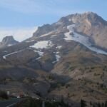
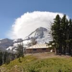
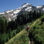
Staying close to tree line all the way around Mt. Hood, the Timberline Trail #600 is a loop of about 40 miles through the Mount Hood Wilderness, with waterfalls, alpine meadows, wide views and west side Cascade forest. The Civilian Conservation Corps built most of it in the 1930s.
Between Timberline Lodge and Yocum Ridge it shares the route with the Pacific Crest Trail #2000. You can hike a section or the full circuit, which takes most backpackers three or four days. Expect to climb in and out of glacier-fed drainages. The river fords, especially White, Sandy, Muddy Fork, Coe and Newton, are usually the hardest part. Ramona Falls and Elk Cove are along the way.
Trail map & elevation
- Trail class
- Class 2 of 5
- Typical grade
- 12-20%
- Surface
- Native material
- Tread width
- 18-24 inches
- Ranger district
- Hood River, Zigzag
Connects to: Ramona Falls Trail #797, Yocum Ridge Trail #771, Top Spur Trail #785
More about the Mount Hood Wilderness and its trails →
Line, length and trail class: U.S. Forest Service trail data. Elevation: USGS 3D Elevation Program. Difficulty is our estimate for hiking it out and back (once around for a loop), from distance and total climb. Lines can be off by a few hundred feet; carry a real map and check the official page for closures.
Things to do
- Outdoor Science and Learning
- Viewing
- Wildlife viewing
Getting there
- The trail begins at a junction with Pacific Crest Trail #2000 north of the Sandy River and ends at a junction with Pacific Crest Trail #2000 1 mile east of Timberline Lodge.
- This trail is located within the Zigzag and Hood River Ranger Districts.
From the Forest Service
Rules and restrictions
Wilderness regulations apply. Campfires are prohibited in these areas:
Within 500 feet of Ramona Falls and McNeil Point
Within the tree covered island in Elk Cove and Elk Meadows
Within Paradise Park
Camping is prohibited in the following locations:
Within any meadow
Within the tree covered islands of Elk Cove and Elk Meadows
Within 500 feet of Ramona Falls
Passes and permits
Free, self-issued Wilderness permits are required from May 15 to October 15 when provided at a portal. Not all trails will have Wilderness portals.
Some trailheads require a day use fee. Check our Recreation Passes and Permits page for details.
Season details
July - October
Trails nearby
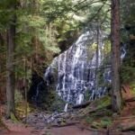 Ramona Falls Trail #797
3.4 mi
589 ft
Moderate
 Yocum Ridge Trail #771
7.8 mi
2,129 ft
Hard
 Top Spur Trail #785
1 mi
348 ft
Easy
 Gnarl Ridge Trail #652
2 mi
382 ft
Easy
 Umbrella/Sahalie Falls Trail #667
6.4 mi
1,420 ft
Hard
 Eden Park Trail #600H
3.4 mi
1,011 ft
Moderate
 Mazama Trail #625
7.6 mi
2,228 ft
Hard
Tilly Jane Trail #600A
3.4 mi
1,077 ft
Moderate
 Newton Creek Trail #646
3.6 mi
1,010 ft
Moderate
Elk Cove Trail #631
10 mi
2,323 ft
Very hard
 Burnt Lake Trail #772
9 mi
1,984 ft
Hard
Paradise Park Loop Trail #757
4.8 mi
1,195 ft
Hard