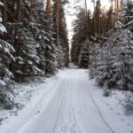
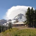
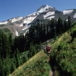
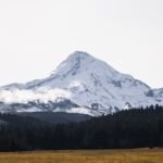
Tilly Jane Trail #600A climbs the northeast side of Mt. Hood from Cloud Cap Saddle Campground, at 5,870 feet, to the Timberline Trail #600 at 6,650 feet. The route climbs through the remains of a 2008 wildfire inside the Mount Hood Wilderness. It’s also a popular ski trail.
It starts with a gentle descent by two spurs to Tilly Jane Campground and a crossing of Tilly Jane Creek, then climbs into the wilderness. The Tilly Jane Shelter is about 0.1 mile up the Timberline Trail. The drive up Cloud Cap Road is narrow and twisting, and high clearance or 4WD might be needed. See our Tilly Jane Sno-Park page for more on the area.
Trail map & elevation
- Trail class
- Class 2 of 5
- Typical grade
- 5-8%
- Surface
- Native material
- Ranger district
- Hood River
Connects to: Tilly Jane Ski Trail #643
More about the Mount Hood Wilderness and its trails →
Line, length and trail class: U.S. Forest Service trail data. Elevation: USGS 3D Elevation Program. Difficulty is our estimate for hiking it out and back (once around for a loop), from distance and total climb. Lines can be off by a few hundred feet; carry a real map and check the official page for closures.
Getting there
From Hood River, OR
- Travel approximately 13.1 miles south on Oregon Hwy 35 and turn right (east) onto Cooper Spur Road, approximately 0.3 miles south of milepost 74.
- Follow Cooper Spur Road 2.4 miles to Cloud Cap Road (Forest Road 3512) and turn left (southeast).
- Follow Cloud Cap Road (Forest Road 3512) approximately 9.8 miles to the trailhead near the Snowshoe Cabin at the Cloud Cap Inn.
- Timberline Trail #600 heads south from the same trailhead.
- Forest Road 3512 is narrow and winding and may require a high-clearance or 4WD vehicle.
From the Forest Service
Rules and restrictions
Wilderness restrictions apply
Passes and permits
A Recreation Pass is required at Cloud Cap Trailhead, located within Cloud Cap Campground, from May 1 to October 31.
Ranger office
Hood River Ranger District
Address: 6780 Highway 35 Parkdale, OR 97041
Phone: 541-352-6002
Hours: Monday to Friday, 8 a.m. to 3 p.m. Closed 12 to 1 for lunch. (Closed on federal holidays)
Trails nearby
 Tilly Jane Ski Trail #643
5.4 mi
1,920 ft
Hard
 Timberline Trail #600
58.6 mi
16,475 ft
Very hard
 Lamberson Spur Trail #644
3.2 mi
1,330 ft
Moderate
 Elk Cove Trail #631
10 mi
2,323 ft
Very hard
Elk Meadows Trail #645
17.6 mi
3,439 ft
Very hard
 Bluegrass Ridge Trail #647
12.2 mi
3,084 ft
Very hard
 Newton Creek Trail #646
3.6 mi
1,010 ft
Moderate
Pinnacle Ridge Trail #630
6 mi
2,160 ft
Hard
 Tamanawas Falls Trail #650A
2.2 mi
458 ft
Easy
Gnarl Ridge Trail #652
2 mi
382 ft
Easy
 Eden Park Trail #600H
3.4 mi
1,011 ft
Moderate