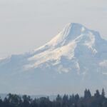
Mt. Hood looks calm from Portland, but it is an active volcano that has erupted off and on for at least 500,000 years, and the USGS expects it to erupt again. Much of what you see today, from the jagged summit to the smooth slope under Timberline Lodge, formed in a few bursts during the last 30,000 years.
Those bursts are rarely violent blasts like Mount St. Helens in 1980. Thick lava piles up near the top as domes, which crumble on the steep slopes into avalanches of hot rock and gas called pyroclastic flows. Their heat melts snow and ice, and the meltwater carries rock downhill as lahars, fast slurries of mud and boulders that can reach the Columbia River.
Ice age domes: the Polallie period
The Polallie eruptive period began roughly 30,000 years ago and lasted until the last ice age was over, closing between 15,000 and 12,000 years ago depending on the USGS source. Domes and stubby lava flows built roughly the top 2,000 feet of the mountain, including Steel Cliff on the east side of the crater. Cooper Spur, east of the summit, is the remnant of a fan of hot debris from that time. Then the mountain went quiet for more than 10,000 years.
The crater opens: the Timberline period
About 1,500 years ago, as the Timberline eruptive period began, a big section of the old summit gave way on the southwest side. The landslide left the breached crater that faces Timberline Lodge, and it became a lahar that swept down the Zigzag and Sandy valleys some 55 miles to the Columbia, leaving boulders up to 8 feet across near today’s Wemme and Wildwood.
New domes grew inside the crater and collapsed again and again for decades. Their debris built the smooth fan under Timberline Lodge and Government Camp, and lahars of this age underlie stretches of US 26 and much of the Sandy River delta. A smaller burst, the Zigzag eruptive period, followed about 400 to 600 years ago along the Zigzag and upper Sandy rivers.
Old Maid and Crater Rock
In 1781, after more than 1,000 years of rest, a new dome began to rise in the crater. Tree rings from forests buried or scarred by the eruptions pin down the dates: this Old Maid eruptive period lasted into the mid-1790s. The dome collapsed over and over, sending hot avalanches and lahars down the Sandy and White rivers. One lahar ran some 40 miles to Tygh Valley. Within about a decade, sand washed off the fresh deposits had buried the floor of the lower Sandy valley more than 65 feet deep, which is why Lewis and Clark, arriving in 1805, called it the Quicksand River.
The battered core of that dome survives as Crater Rock, the dark knob in the crater below the summit. Steam vents called fumaroles still rise around it, and their rotten-egg smell comes from gas whose chemistry tells scientists that magma lies a few miles down.
Smoke and steam in the 1800s
Settlers reported smaller outbursts. A letter printed in the November 1859 American Journal of Science and Arts told of odd clouds over the summit that August, then flashes of light and billowing vapor for several nights. In September 1865, a correspondent of The Oregonian at Fort Vancouver reported smoke, flame and what looked like flying rock, seen by soldiers on guard. Newspapers said the mountain was smoking again late in 1866.
These may describe small steam explosions from the cooling Old Maid dome, but nobody has found a deposit that clearly dates to the 1859 or 1865 events. The USGS still lists 1865 as the most recent eruption.
Active and watched
Mt. Hood is not erupting, but the USGS rates its threat potential as very high, because towns, highways and water supplies lie close by. It is Oregon’s most seismically active volcano, with one or two small earthquakes located within 3 miles of the summit in a typical month. The Pacific Northwest Seismic Network and the USGS Cascades Volcano Observatory watch it through five seismic stations within 12 miles, and USGS scientists have sampled the fumaroles at Crater Rock every year since 2008.
Scientists expect the next eruption to look much like Old Maid, with lahars as the biggest threat to the Sandy and White river valleys. Lahars can also come with no eruption at all. On Christmas Day 1980, a rainstorm set off a lahar in Polallie Creek. It killed a camper, and the flood that followed wiped out three bridges, a state park and 5 miles of highway.
See it today
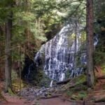
From the parking area at Timberline Lodge, look up: the breached crater, Crater Rock inside it and Steel Cliff on its east wall are all in view. An easy walk east on the Timberline Trail, about 2 miles round trip, ends at the edge of the White River canyon. Down on Highway 35, a tall terrace on the west bank of the White River, a short way north of the White River West Sno-Park, exposes an Old Maid pyroclastic flow. On the west side, McNeil Campground sits on an old mudflow beside the Sandy River, and the Forest Service points out signs of a debris flow more than 200 years old along the Ramona Falls Trail. For current volcano status, check the USGS Mount Hood page.