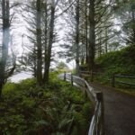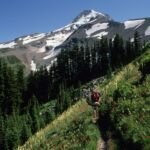
Meadows, wildflowers and close-up views of Mt. Hood’s north side are the highlights of Elk Cove Trail #631, which climbs through the Mount Hood Wilderness to Timberline Trail #600. The Elk Cove Trailhead is on Forest Road 2840 near Kinnikinnick Campground at Laurance Lake, and a high-clearance vehicle is a good idea for Laurance Lake Road.
You start by walking an old road for about a mile; a rock cairn marks where the trail heads off. From there it follows a ridge for 1.9 miles, crosses a shallow stream and climbs a ravine to the Timberline Trail. The Dollar Fire burned parts of this route, so watch for dead trees, especially when it’s windy.
Trail map & elevation
- Trail class
- Class 3 of 5
- Typical grade
- 12-20%
- Surface
- Native material
- Tread width
- 18-24 inches
- Ranger district
- Hood River
Connects to: Timberline Trail #600
More about the Mount Hood Wilderness and its trails →
Line, length and trail class: U.S. Forest Service trail data. Elevation: USGS 3D Elevation Program. Difficulty is our estimate for hiking it out and back (once around for a loop), from distance and total climb. Lines can be off by a few hundred feet; carry a real map and check the official page for closures.
Getting there
From Hood River, OR
- Take Oregon Hwy 35 south 15 miles to the town of Mount Hood.
- Turn right at Oregon Hwy 281 (Cooper Spur Rd), near milepost 85, and travel 2 miles to the town of Parkdale.
- From the center of Parkdale, go south on Clear Creek Road (across from McIsaac's Store) and travel approximately 2.7 mi to Laurance Lake Road (Forest Road 2840).
- Go right (west) on Laurence Lake Road 4.2 miles to Kinnikinnick Campground at Laurance Lake.
- Just west of Kinnikinnick Campground, leave the pavement, turn left and head south onto Forest Road 2840 for approximately 1.1 miles to the trailhead starting at Forest Road 2840-650.
From the Forest Service
Good to know
High-clearance vehicles are highly recommended for Laurance Lake Road.
Rules and restrictions
Wilderness restrictions apply.
Trails nearby
 Timberline Trail #600
39.2 mi loop
11,267 ft
Very hard
 Pinnacle Ridge Trail #630
6 mi round trip
2,160 ft
Hard
 Laurance Lake High Ridge Trail
7 mi round trip
2,336 ft
Hard
 Eden Park Trail #600H
3.4 mi round trip
1,011 ft
Moderate
 Vista Ridge Trail #626
5 mi round trip
1,159 ft
Hard
 McNeil Point Trail
1.8 mi round trip
635 ft
Easy
 Mazama Trail #625
7.6 mi round trip
2,228 ft
Hard
 Wagon Road Trail #642
4.4 mi round trip
1,462 ft
Tilly Jane Trail #600A
3.4 mi round trip
1,077 ft
Moderate
Tilly Jane Ski Trail #643
5.4 mi round trip
1,920 ft
Hard