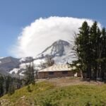
In the early 1920s, road crews closed the last gap around Mt. Hood. On June 30, 1924, a caravan of cars with federal, state and county officials, business leaders and reporters left Portland, climbed to Government Camp, rounded the east side of the mountain to Hood River and came home along the Columbia River Highway. The Federal Highway Administration counts it as the first complete circuit of the peak by the new Loop Highway: 173 miles in eight hours.
The loop turned a rough wagon crossing into a day’s drive. It set off a wave of recreation planning and cabin building in the national forest, and much of it is still in use as the Mt. Hood Scenic Byway, along US 26 and OR 35.
Two roads to the mountain
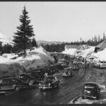
By 1920, motorists had two main ways into the Mt. Hood country, according to a Forest Service guide published that year. The Columbia River Highway, dedicated in June 1916, ran east from Portland through the gorge and was hard surfaced nearly to Hood River. The other route followed the old Barlow Road over the Cascades south of the peak. Past Sandy it turned to plank and dirt. Cars usually stopped at Government Camp, and the guide warned that pushing on to Wapinitia in summer took skilled, careful driving.
The east side was the missing link. From Hood River, cars could get only as far as the upper valley. The guide described a loop road under construction from the west that would cross the mountain’s southeastern slopes, through country then reached only by trail, so that drivers could one day circle the whole peak.
The idea had been around for a few years. Researchers for the byway’s management plan found newspaper suggestions from 1918 that a highway should follow the Barlow route to the mountain as a memorial to World War I soldiers.
Building the loop
In 1919 the State of Oregon took over the Barlow Road, and work began on a modern highway that roughly followed the wagon route, a Forest Service history of the area says. The 1920 guide adds that the old road had been free of tolls since 1919. Inside the national forest, the federal Bureau of Public Roads supervised construction of a 37-mile section.
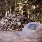
The work turned up a reminder of the road’s past. In 1924, engineers building the highway below Barlow Pass found a forgotten grave beside the old emigrant trail. Nobody knows the woman’s name, and the spot is known today as the Pioneer Woman’s Grave. The byway plan gives 1924 as the year the loop was completed, the same summer as the caravan.
A playground for Portland
The Forest Service saw the crowds coming. In 1923, with the highway nearly done, a recreation plan for the Loop corridor by F.W. Cleator predicted heavier use of the forest along the road and set aside land for summer homes. In 1926, Secretary of Agriculture W.M. Jardine set aside land along the road as the Mt. Hood Recreation Area, naming recreation, including summer homes, as its main value.
Cabins followed. Planning and surveying for summer home tracts took off in the 1920s, and building went on until about 1940. A Forest Service brochure from the 2000s counted 554 privately owned summer cabins in the Zigzag Ranger District, most of them more than 50 years old.
From loop road to scenic byway
Today’s US 26 and OR 35 follow much of the old route, but in places the modern highway left the 1920s roadbed behind. Some of those bypassed pieces survive on their own as forest roads and trail segments.
The route is now the Mt. Hood Scenic Byway, a National Scenic Byway of about 105 miles. It runs from Troutdale through Sandy and Government Camp on US 26, then north on OR 35 through the Hood River Valley to Hood River. Paired with the Historic Columbia River Highway, it still makes the full circle from Portland that the 1924 caravan drove.
See it today
Several stretches of the original road are easy to visit.
- Laurel Hill: From a pullout on US 26, the Laurel Hill Chute Trail climbs about 60 stone steps to a macadam piece of the old Loop Highway, then continues to a chute where emigrants once lowered their wagons.
- Pioneer Woman’s Grave: Forest Road 3531, near Barlow Pass, is part of the old highway. The grave its builders found is beside a small pullout at the Pioneer Woman’s Grave Trailhead, and the Pioneer Woman’s Grave Trail passes wagon swales nearby.
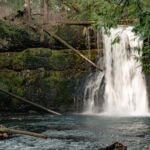
- Sahalie Falls: On the east side, a section of the 1924 highway passes Hood River Meadows and Sahalie Falls, with an old stone bridge below the falls. Start at Sahalie Falls Viewpoint or the Umbrella/Sahalie Falls Trail.
- Government Camp: One of the town’s streets still carries the name Old Mt. Hood Loop Highway.
To drive the whole circle, take US 26 east from Portland to OR 35, go north to Hood River, and return west along the Columbia. Check Mt. Hood road conditions before you set out.