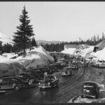
In the fall of 1845, Oregon Trail families who reached The Dalles faced one last barrier, the Cascade Range. Wagons had to go down the Columbia by boat or raft, often after a long and costly wait.Samuel K. Barlow decided to cut a wagon road around the south side of Mt. Hood instead. Snow stopped him that first year, but in 1846 he opened the route as a toll road, and it carried emigrants, drovers and later tourists over the mountains for more than 70 years.
The Barlow Road became the last overland stretch of the Oregon Trail. Its National Register nomination calls it the first wagon road to cross the Cascades anywhere in Oregon or Washington.
The 1845 trek
Barlow’s company reached The Dalles late in September 1845 and found some 60 families already waiting for two small boats. Rather than wait at least ten days and pay a steep fare, Barlow left on September 24 with 19 adults, several children and seven wagons, heading south toward Tygh Valley. The route leaned on Native paths. The party camped near a Tygh village, and later packed out along an Indian trail on the mountain’s south flank, the National Park Service notes. Joel Palmer’s 23-wagon company soon joined them.
Crews hacked a wagon-wide lane through big timber and rhododendron thickets while Palmer scouted ahead, once climbing above timberline to study the passes. By late October snow threatened and food was short. The men built a cabin they called Fort Deposit, probably at the eastern foot of Barlow Pass, cached the wagons and goods there, and set out on foot and horseback. They crossed the rainy west slope, skidded down Laurel Hill and reached Philip Foster’s farm near Eagle Creek on December 23. No one in the company died.
A toll road opens
That December, Oregon’s Provisional Legislature granted Barlow a charter for a toll road. With Foster’s backing he hired a crew in the spring of 1846 to open the road from Foster’s farm back to the cached wagons. He charged $5 a wagon and 10 cents a head for livestock. That first season roughly a thousand emigrants and about 150 wagons came over the road.
Travelers paid, but many resented it. Some signed promissory notes or handed over clothing, and in 1897 the gatekeeper took bacon, a washboard and a jug from one man who had no cash. Even so, the Park Service estimates that about three of every four later Oregon emigrants chose Barlow’s road over the river.
Laurel Hill
West of today’s Government Camp the road dropped off Laurel Hill, the ridge dividing the Zigzag River from Camp Creek. The Park Service calls it the hardest descent on the entire Oregon Trail, with a grade near 60 percent. Emigrants chained their wheels, tied felled trees up to 40 feet long behind their wagons as drags, and let the wagons down with ropes wrapped around stumps. Years of skidding wheels and winter rain gouged at least five chutes, some seven feet deep. Wagons could not climb back up, so the road ran one way, east to west, until gentler descents opened in the mid-1850s or 1861, depending on the source.
Owners, gates and the state
Barlow collected the tolls himself for about two years, then leased the road to others, Foster among them. A string of companies followed. The Cascade Road and Bridge Company, formed in 1864, built bridges and laid log corduroy across the swamps, and in 1882 the road passed to a new firm, Mount Hood and Barlow Road Company. The tollgate changed places several times, starting at Gate Creek near Tygh Valley and ending on a narrow terrace on the Zigzag River just east of Rhododendron, where hillside and river left no way around it.
In 1903 Oregon voters turned down a measure to buy the road and end the tolls, and the state later declined an offer to sell it for $24,000. Henry Wemme bought it in 1912 for $5,000. After his death it passed to his attorney, George Joseph, and on September 8, 1919, George and Bertha Joseph deeded it to the State of Oregon for one dollar, “for the use, benefit and pleasure of all forever,” as the deed put it. Sources differ on when the last tolls were taken, 1915 or 1919. The state used the right of way for the Mt. Hood Loop Highway, which opened in 1924.
See it today
- Laurel Hill: The short Laurel Hill Chute Trail climbs stone steps to an abandoned piece of the 1920s highway, then switchbacks up to a viewpoint at the top of a wagon chute.
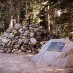
- Barlow Pass: The road’s high point, about 4,160 feet, is at the Barlow Pass Sno-Park, where the old road crosses the parking lot and meets the Pacific Crest Trail. The Pioneer Woman’s Grave Trail follows it downhill from there.
- East of the pass: Forest Road 3530 follows much of the original route past Barlow Crossing Campground, and the Devils Half Acre Trail walks part of the old grade.
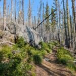
- Government Camp: The Barlow Trail keeps a rocky, rutted stretch of the road south of town.
- Tollgate: Near Tollgate Campground, a replica gate stands between two maples that toll keeper Daniel Parker planted in the late 1880s. The Pioneer Bridle Trail follows pieces of the road down from Government Camp.