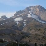
Mt. Hood’s English name was given from the bank of the Columbia River. In late October 1792, Lt. William Broughton of the Royal Navy was rowing upriver for Capt. George Vancouver’s expedition when a snowy peak rose far to the east, and he named it for Lord Samuel Hood, a British admiral. Thirteen years later, Lewis and Clark watched the same peak for weeks before working out that it was Broughton’s mountain.
The mountain had names long before 1792. As the Forest Service puts it, the peoples who lived around it called it different things depending on their tribe or group and on when and where they lived. Our About Mt. Hood page covers Native homelands; this page follows the explorers.
Broughton’s row up the Columbia
Vancouver’s ships, the Discovery and the smaller armed tender Chatham, reached the mouth of the Columbia in October 1792. When the Discovery put back to sea in a gale on October 21, Broughton kept the Chatham inside the river to explore it. Leaving the Chatham at anchor, he set off upstream with two boats, a cutter and a launch, rowing against a strong current.
On October 29, from a spot he named Belle Vue Point, a little downstream of today’s Vancouver, Washington, the party saw a very high, snowy mountain far to the east that seemed to mark the end of the river. The next day Broughton landed to take his last bearings. He named the sandy point that closed off his view upriver Point Vancouver, after his captain, and gave the mountain Lord Hood’s name. He guessed it was at least 20 leagues away and regretted that he could not fix its exact position. After seven days of hard rowing, about 100 miles from the ship and nearly out of food, he turned back, but first he formally claimed the river and the country around it for the British king.
Lewis and Clark’s Timm Mountain
The Corps of Discovery reached the Columbia in October 1805. On October 18, where the Walla Walla River meets the Columbia, William Clark noted a cone-shaped, snow-covered mountain to the southwest, most likely Mt. Hood. A National Park Service article says October 19. By October 21, Clark understood that the peak stood not far from the great falls of the Columbia, and he took to calling it the Timm or Falls Mountain. From the expedition’s camp at The Dalles on October 25, he judged it about 37 miles off.
The Quicksand River
On November 3, after passing through the Columbia Gorge, the expedition stopped at the mouth of a broad, shallow river on the south bank. Clark tried to wade it and found a bottom of quicksand he could not cross. He and Lewis walked about a mile and a half upstream and found a river spilling so much coarse sand into the Columbia that a bar 3 miles long had built up at its mouth. Clark compared it to the Platte, and the captains called it the Quicksand River. That same day Clark wrote of “a Mountain which we Suppose to be Mt. Hood,” the first time the journals give the peak Broughton’s name.
The captains could not know why the river was so sandy. Mt. Hood’s Old Maid eruptions, which began in 1781 and ended in the mid-1790s, had sent huge loads of volcanic sand and rock into the river’s headwaters, and it was still flushing them out. Since then the river has carried off the extra sediment and settled into a narrower, deeper channel, and its name has been shortened to the Sandy.
A short river points to a long one
The expedition headed back up the Columbia in spring 1806. From March 31 they camped at Cottonwood Beach near today’s Washougal, Washington, across from the upper mouth of the Quicksand, with Mt. Hood about 40 miles due east. On April 1 the captains sent Sgt. Pryor and two men up the Quicksand by canoe. They got about 6 miles and found a channel only about 50 yards wide, running through a bed of quicksand some 300 yards across.
A large wooden house of the Watlala people stood nearby, and the National Park Service notes that the captains learned a great deal about the river from area villagers. Several tribes told them the Quicksand began on Mt. Hood. That news changed their map: a river so short could not drain the broad valley to the south, so another large river had to reach the Columbia somewhere they had missed. On April 2 Clark set out to find it and reached the river the expedition called the Multnomah, known today as the Willamette.
See it today
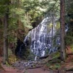
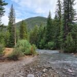
The Quicksand River is now the Sandy, and you can follow it toward its source on Mt. Hood. Inside the national forest, the Sandy River Trail briefly follows the river near the Old Maid Sand Pit parking area, and the Ramona Falls Trail runs near the Sandy where the Forest Service points out signs of a volcanic debris flow more than 200 years old. Near Troutdale, the Sandy River Delta, where Clark tried to wade, is a site on the Park Service’s Lewis and Clark National Historic Trail, and much of it is a Forest Service park. On a clear day, Mt. Hood still rises due east from the Columbia near Washougal, as Clark recorded in 1806.