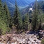
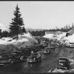
Laurel Hill gave Oregon Trail pioneers their hardest descent. On the southern slopes of Mt. Hood, the hill fell away in three steep pitches, and emigrants headed for Oregon City had to lower their wagons down a rocky chute. This short loop, Laurel Hill Chute Trail #759A, lets you see that chute and read an interpretive sign.
Going counterclockwise, climb a stone staircase to an old abandoned road, follow it 0.1 mile southeast, then switchback up 0.2 mile to a viewpoint. Another 0.2 mile returns you to the old road; head north on it to finish. Park at a pullout along US Highway 26 between mileposts 50 and 51, reachable only when driving east.
Trail map & elevation
- Trail class
- Class 3 of 5
- Typical grade
- 12-20%
- Surface
- Native material
- Tread width
- 18-24 inches
- Ranger district
- Zigzag
Connects to: Pioneer Bridle Trail #795
Line, length and trail class: U.S. Forest Service trail data. Elevation: USGS 3D Elevation Program. Difficulty is our estimate for hiking it out and back (once around for a loop), from distance and total climb. Lines can be off by a few hundred feet; carry a real map and check the official page for closures.
Things to do
- Outdoor Science and Learning
- Interpretive sites
Getting there
From Portland, OR
- travel 26 miles east of Sandy on US Hwy 26 to a small pullout on the south side of the Hwy. The pullout is located on Hwy 26 between mileposts 50 and 51.
- Parking is only accessible traveling EAST on Hwy. 26.
- Lat/long: 45.31108, -121.80110
Trails nearby
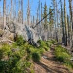 Pioneer Bridle Trail #795
16 mi round trip
2,488 ft
Very hard
 Hidden Lake Trail #779
8.4 mi round trip
2,694 ft
Very hard
 Little Zigzag Falls Trail #795C
1.2 mi round trip
311 ft
Easy
 Paradise Park Trail #778
13.8 mi round trip
3,574 ft
Very hard
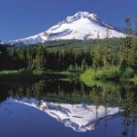 Mirror Lake Trail #664
7 mi round trip
1,695 ft
Hard
Glacier View Trail #692B
1.8 mi round trip
175 ft
 Enid Lake Trail #692A
0.8 mi round trip
212 ft
 Crosstown Trail #755
5.4 mi round trip
618 ft
Moderate
 Maggie’s Trail #753
0.8 mi round trip
80 ft
Easy
 Lucy’s Trail #752
0.4 mi round trip
21 ft
Easy