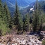
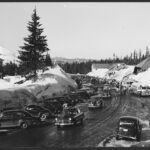
Wagons and livestock once moved along this route, part of the historic Barlow Road and one of the final stretches of the Oregon Trail. Barlow Trail #601A links Still Creek Campground with Government Camp, just off US Highway 26.
To protect that history, the trail is kept more primitive than others nearby, so expect a rocky, ditch-like path that probably looks much as it did in the 1850s. Near Still Creek Campground, watch the woods off the trail for old foundations and fireplace bricks left from Swim Mineral Springs, a resort that operated in the 1920s. At Government Camp, the trail starts beyond the State Highway Department lot across from Timberline Road.
Trail map & elevation
- Trail class
- Class 3 of 5
- Typical grade
- 10-12%
- Surface
- Native material
- Tread width
- 18-24 inches
- Ranger district
- Zigzag
Connects to: Hemlock Trail #691A, Summit Trail #691
Line, length and trail class: U.S. Forest Service trail data. Elevation: USGS 3D Elevation Program. Difficulty is our estimate for hiking it out and back (once around for a loop), from distance and total climb. Lines can be off by a few hundred feet; carry a real map and check the official page for closures.
Getting there
- To access the EAST end from Portland- take U.S. Hwy 26 ~29.5 miles east of Sandy towards Government Camp and turn right (south) on Still Creek Campground Road (Forest Road 2650).
- Drive 0.3 miles south into the campground and parking area.
- The trailhead is located on the western leg of campground loop.
- Parking and trailhead are on the west side of the road.
- Vehicles are not allowed access to the campground during the winter season.
- To access the WEST end from Portland- take U.S. Hwy 26 east towards of Government Camp.
- Travel 29.2 miles east of Sandy and turn right (south) into the State Highway Department (across from Timberline Road).
- Follow the access trail at the west end of the parking lot into summit compound (a collection of forest service buildings) to the junction with the west end of the Barlow Trail #601A and the east end of Hemlock #691A.
From the Forest Service
Passes and permits
State of Oregon Sno-Park permit required November 1 through April 30 at trailhead on US 26.
Trails nearby
 Hemlock Trail #691A
1.4 mi round trip
170 ft
 Summit Trail #691
4 mi round trip
430 ft
Moderate
Crosstown Trail #755
5.4 mi round trip
618 ft
Moderate
 Yellowjacket Trail
10.8 mi round trip
1,317 ft
Alpine Trail
4.2 mi round trip
1,424 ft
 White Away Trail
1.8 mi round trip
292 ft
 Camp Creek Loop Trail #754
2.4 mi round trip
414 ft
Easy
 Glade Trail #661
5.4 mi round trip
1,920 ft
Snowbunny Trail
3.6 mi round trip
567 ft
 Timberline to Town Trail #756
9.8 mi round trip
1,851 ft
Hard
 Still Creek Road Trail
24.8 mi round trip
2,653 ft
 Trillium Lake Loop Trail #761
1.8 mi loop
11 ft
Easy