On Mount Hood’s north side, Pinnacle Ridge Trail #630 climbs its namesake ridge in the Mount Hood Wilderness toward Wy’east Basin and Barrett Spur. It rises from the Pinnacle Ridge Trailhead, at about 3,720 feet, to the Timberline Trail #600 at about 5,760 feet, with alpine meadows and close views of the mountain’s snowfields near the top.
The lower half has a moderate grade. The upper half is steeper and narrower, with a boggy meadow where the tread fades for a bit. From the top, Dollar Lake and Eden Park make nearby side trips, and an 8.7-mile loop returns by Elk Cove Trail #631. A high-clearance vehicle is recommended for Laurance Lake Road.
Trail map & elevation
- Trail class
- Class 2 of 5
- Typical grade
- 12-20%
- Surface
- Native material
- Tread width
- 18-24 inches
- Ranger district
- Hood River
More about the Mount Hood Wilderness and its trails →
Line, length and trail class: U.S. Forest Service trail data. Elevation: USGS 3D Elevation Program. Difficulty is our estimate for hiking it out and back (once around for a loop), from distance and total climb. Lines can be off by a few hundred feet; carry a real map and check the official page for closures.
Getting there
From Hood River
- take Highway 35 south 15 miles to the town of Mount Hood.
- Turn right at Oregon Hwy 281 (Cooper Spur Rd), near milepost 85, and travel 2 miles to the town of Parkdale.
- From the center of Parkdale, go south on Clear Creek Road (across from McIsaacs Store) and travel 2.7 miles to Laurance Lake Road (Forest Road 2840).
- Head right (west) on Laurance Lake Road 4.2 miles to Kinnikinnick Campground at Laurance Lake.
- Just west of Kinnikinnick Campground, leave the pavement, turn left and head south on Forest Road 2840 for 2.8 miles to Forest Road 2840-670.
- Take Forest Road 670 uphill 0.15 mile on an improved but steep road to the trailhead.
- The trail heads south from the south side of the road.
From the Forest Service
Rules and restrictions
Wilderness restrictions apply
Passes and permits
Free, self-issued wilderness permits are required in Mt. Hood National Forest wilderness from May 15 through October 15 when provided at a portal.
Season details
Usually accessible in May
Trails nearby
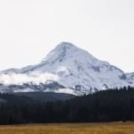 Eden Park Trail #600H
3.4 mi round trip
1,011 ft
Moderate
 Timberline Trail #600
39.2 mi loop
11,267 ft
Very hard
 Vista Ridge Trail #626
5 mi round trip
1,159 ft
Hard
 Elk Cove Trail #631
10 mi round trip
2,323 ft
Very hard
McNeil Point Trail
1.8 mi round trip
635 ft
Easy
 Laurance Lake High Ridge Trail
7 mi round trip
2,336 ft
Hard
 Mazama Trail #625
7.6 mi round trip
2,228 ft
Hard
 Wagon Road Trail #642
4.4 mi round trip
1,462 ft
Tilly Jane Trail #600A
3.4 mi round trip
1,077 ft
Moderate
 Yocum Ridge Trail #771
7.8 mi round trip
2,129 ft
Hard