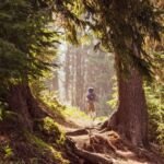
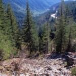
History and wildflowers set Devils Half Acre Trail #482A apart. It follows pieces of the historic Barlow Road through the Mount Hood Wilderness, winding through old-growth forest and a wildflower meadow. Find the start 0.15 mile down Barlow Road (Forest Road 3531) from OR Hwy 35, near milepost 60.
After 0.3 mile the trail parts ways with Barlow Butte Trail #670, turning south for 0.7 mile to reach Devils Half Acre Campground, then follows Devils Half Acre Road for 0.4 mile before crossing several small streams to end at Palmateer Trail #482. Return the same way, or go west on Palmateer and north on the Pacific Crest Trail for a 4-mile loop back to the start.
Trail map & elevation
- Trail class
- Class 3 of 5
- Typical grade
- 12-20%
- Surface
- Native material
- Tread width
- 18-24 inches
- Ranger district
- Hood River
Connects to: Palmeteer Trail #482
More about the Mount Hood Wilderness and its trails →
Line, length and trail class: U.S. Forest Service trail data. Elevation: USGS 3D Elevation Program. Difficulty is our estimate for hiking it out and back (once around for a loop), from distance and total climb. Lines can be off by a few hundred feet; carry a real map and check the official page for closures.
Things to do
- Outdoor Science and Learning
- Viewing
Getting there
From Hood River, OR
- Travel 36.2 miles south on Oregon Hwy 35 to Barlow Pass Sno-Park (Forest Road 3531), approximately 200 feet west of milepost 60.
- Head down Barlow Road 0.15 mile to the trailhead.
From Portland, OR
- Travel approximately 31 miles east of Sandy on US Hwy 26 to the intersection with Oregon Hwy 35.
- Turn north onto Oregon Hwy 35 and travel 2.6 miles to Barlow Pass Sno-Park (Forest Road 3531), approximately 200 feet west of milepost 60.
- Head down Barlow Road 0.15 mile to the trailhead.
From the Forest Service
Rules and restrictions
Wilderness restrictions apply.
Trails nearby
 Palmeteer Trail #482
4 mi round trip
970 ft
Moderate
 Pacific Crest Trail (Hood River RD)
40.4 mi round trip
6,003 ft
Very hard
 Twin Lakes Trail #495
6 mi round trip
950 ft
Hard
 Barlow Butte Trail #670
10 mi round trip
4,075 ft
Very hard
 Pioneer Woman’s Grave Trail #485
2 mi round trip
451 ft
Easy
 Pacific Crest Trail (Zigzag RD)
85.4 mi round trip
16,324 ft
Very hard
 Snowbunny Trail
3.6 mi round trip
567 ft
 Yellowjacket Trail
10.8 mi round trip
1,317 ft
 Upper White River Trail
2 mi round trip
430 ft
 Trillium Lake Loop Trail #761
1.8 mi loop
11 ft
Easy
 Blue Box Trail #483
7.4 mi round trip
1,821 ft
Hard
 Frog Lake Trail #530
2 mi round trip
836 ft
Moderate