
Snow Bunny Sno-Park is the jumping-off point for Snowbunny Trail, which belongs to the Government Camp trail system. From there it runs to a point the Forest Service calls Top of Hill in Plantation.
Once snow arrives, it becomes a route for cross-country skiing and snowshoeing, and its start at the Sno-Park makes it a natural first leg for exploring more of the network. To get there from Sandy, drive east on US Highway 26 to a spot about 2.5 miles beyond the Timberline Road junction.
Trail map & elevation
- Trail class
- Class 3 of 5
- Typical grade
- 10-12%
- Surface
- Snow
- Tread width
- <12 inches
- Ranger district
- Zigzag
Connects to: White Away Trail, Yellowjacket Trail
Line, length and trail class: U.S. Forest Service trail data. Elevation: USGS 3D Elevation Program. Difficulty is our estimate for hiking it out and back (once around for a loop), from distance and total climb. Lines can be off by a few hundred feet; carry a real map and check the official page for closures.
Getting there
From Sandy, OR
- travel East on US Highway 26 to just 2.5 miles east of Timberline Road.
From the Forest Service
Passes and permits
Oregon Sno-Park permit is required from November 1 through April 30 at most Mt. Hood Sno-Parks.
Ranger office
Zigzag Ranger District
Address: 70220 E Highway 26 Zigzag, OR 97049
Phone: 503-622-3191
Hours: Monday to Friday, 8 a.m. to 4 p.m. Closed 12 to 1 for lunch. (Closed on federal holidays)
Trails nearby
 White Away Trail
1.8 mi round trip
292 ft
 Yellowjacket Trail
10.8 mi round trip
1,317 ft
 Still Creek Road Trail
24.8 mi round trip
2,653 ft
 Hemlock Trail #691A
1.4 mi round trip
170 ft
 Barlow Trail #601A
1.4 mi round trip
218 ft
Easy
 Sherar Burn Road Trail #2613
18 mi round trip
2,557 ft
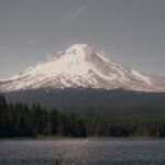 Trillium Lake Loop Trail #761
1.8 mi loop
11 ft
Easy
 Pioneer Woman’s Grave Trail #485
2 mi round trip
451 ft
Easy
 Summit Trail #691
4 mi round trip
430 ft
Moderate
Alpine Trail
4.2 mi round trip
1,424 ft
 Eureka Peak Trail #671
2.4 mi round trip
972 ft
Moderate
Devils Half Acre Trail #482A
1.8 mi round trip
562 ft
Easy