Running along the north side of Government Camp, Crosstown Trail #755 lets you travel across town on foot, bike or skis, and it ties into several other trails, which makes it an important link in the area.
Over its 3 miles the trail rolls, gaining 400 feet from west to east, with lodgepole pine at the east end and hemlock, western red cedar and Douglas fir toward the west. Its grade suits adventurous beginner mountain bikers and cross-country skiers. Start from the Glacier View lot across from Ski Bowl or the Summit Ski Area lot, and add Maggie’s Trail #753 and Skiway Trail #755B for a 4.1-mile loop.
Trail map & elevation
- Trail class
- Class 3 of 5
- Typical grade
- 5-8%
- Surface
- Native material
- Tread width
- 18-24 inches
- Ranger district
- Zigzag
Connects to: Pioneer Bridle Trail #795, Wally’s Tie Trail #755A, Skiway Trail #755B, Maggie’s Trail #753, Camp Creek Loop Trail #754
Line, length and trail class: U.S. Forest Service trail data. Elevation: USGS 3D Elevation Program. Difficulty is our estimate for hiking it out and back (once around for a loop), from distance and total climb. Lines can be off by a few hundred feet; carry a real map and check the official page for closures.
Getting there
- To access the WEST end of Crosstown Trail #755 from Portland - travel 27.5 miles east of Sandy on US Hwy 26.
- Turn left (north) at the Glacier View Sno-park (Forest Road 2600-522) (across from the west entrance to Ski Bowl).
- The trailhead is on the east side of the parking area towards Government Camp.
- To access the EAST end of the Crosstown Trail #755 from Portland- travel approximately 29 miles east of Sandy on US Hwy 26 to Government Camp.
- Pass the first entrance (on left) for the Government Camp Loop Road and continue on US Hwy 26 for about a mile toward the east end of the Government Camp (second flashing light).
- Turn left (north) onto Government Camp Loop Road.
- Travel 150 feet and turn right (east) into the Summit Ski area parking lot.
- The trailhead for the Crosstown Trail #755 is located at the northwest end of the parking lot.
From the Forest Service
Passes and permits
State of Oregon Sno-Park permit required November 1 through April 30.
A valid Recreation Pass is required at Glacier View Trailhead from May 1 to Oct 31.
Trails nearby
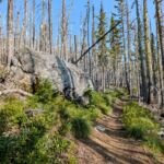 Pioneer Bridle Trail #795
16 mi
2,488 ft
Very hard
 Wally’s Tie Trail #755A
0.6 mi
13 ft
Easy
Skiway Trail #755B
1.4 mi
258 ft
Easy
 Maggie’s Trail #753
0.8 mi
80 ft
Easy
 Camp Creek Loop Trail #754
2.4 mi
414 ft
Easy
 Lucy’s Trail #752
0.4 mi
21 ft
Easy
Barlow Trail #601A
1.4 mi
218 ft
Easy
 Summit Trail #691
4 mi
430 ft
Moderate
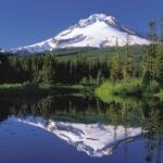 Mirror Lake Trail #664
7 mi
1,695 ft
Hard
 Hidden Lake Trail #779
8.4 mi
2,694 ft
Very hard
 Paradise Park Loop Trail #757
4.8 mi
1,195 ft
Hard
 Paradise Park Trail #778
13.8 mi
3,574 ft
Very hard