Starting from a parking lot on Hwy 35 about 20 miles south of Hood River, Dog River Trail #675 climbs the east side of Mount Hood to meet Surveyor’s Ridge Trail #688 and Zigzag Trail #678. The views come on the upper section, including two Mount Hood viewpoints.
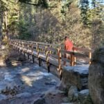
You’ll cross Puppy Creek and Dog River on wooden bridges, follow the hillside above Dog River, and climb to a saddle above the East Fork Hood River. Several small bridges come near the top. Intermediate and advanced mountain bikers like it, and its links to other trails make loops of different lengths easy to build. The 44 Trails Association is a partner in maintaining it.
Trail map & elevation
- Trail class
- Class 2 of 5
- Typical grade
- 12-20%
- Surface
- Native material
- Tread width
- 18-24 inches
- Ranger district
- Hood River
Connects to: Zig Zag Trail #678, Surveyor’s Ridge Trail #688
Line, length and trail class: U.S. Forest Service trail data. Elevation: USGS 3D Elevation Program. Difficulty is our estimate for hiking it out and back (once around for a loop), from distance and total climb. Lines can be off by a few hundred feet; carry a real map and check the official page for closures.
Getting there
From Hood River, OR
- Drive south on Highway 35 for about 20 miles.
- You will pass the Hood River Ranger Station.
- About 5 miles past the Hood River Ranger Station and just before you cross the East Fork of the Hood River you will see a parking lot on the left side of the highway.
- This is the trailhead to Dog River.
Trails nearby
 Zig Zag Trail #678
1.8 mi round trip
892 ft
Moderate
 Surveyor’s Ridge Trail #688
35 mi round trip
6,218 ft
Very hard
East Fork Trail #650
14 mi round trip
1,820 ft
Very hard
 Elk Meadows Trail #645
17.6 mi round trip
3,439 ft
Very hard
 Tamanawas Falls Trail #650A
2.2 mi round trip
458 ft
Easy
 Tamanawas Tie Trail #650B
0.8 mi round trip
237 ft
Easy
 Bluegrass Ridge Trail #647
12.2 mi round trip
3,084 ft
Very hard
Lamberson Spur Trail #644
3.2 mi round trip
1,330 ft
Moderate
Cooks Meadow Trail #639
13.4 mi round trip
2,512 ft
Very hard
 Tilly Jane Ski Trail #643
5.4 mi round trip
1,920 ft
Hard
 Thoroughbred Trail #427
4.2 mi round trip
648 ft
Moderate
North Section Line Trail #451
9 mi round trip
1,471 ft
Hard