
Wildflowers and glimpses of Mount Hood are part of the draw at Cast Lake, in the Mount Hood Wilderness. This half-mile trail leaves Zigzag Mountain Trail #775, climbs 0.2 mile, then drops 0.3 mile to the lake, where it forks: right for the north end, left for the south end.
Several campsites sit on bluffs above the north and east shores, and high points along the shore look toward the mountain. One way in starts on Forest Road 1825-382, reached by Lolo Pass Road: follow Burnt Lake Trail #772 northeast for 2.4 miles, then the 0.3-mile Devils Tie Trail #767, then Zigzag Mountain Trail north for 0.2 mile. That puts the lake about 3.4 miles from the start.
Trail map & elevation
- Trail class
- Class 3 of 5
- Typical grade
- 12-20%
- Surface
- Native material
- Tread width
- 18-24 inches
- Ranger district
- Zigzag
Connects to: Zigzag Mountain Trail #775
More about the Mount Hood Wilderness and its trails →
Line, length and trail class: U.S. Forest Service trail data. Elevation: USGS 3D Elevation Program. Difficulty is our estimate for hiking it out and back (once around for a loop), from distance and total climb. Lines can be off by a few hundred feet; carry a real map and check the official page for closures.
Getting there
From Sandy, OR
- head east on Highway 26 about 30 miles to the junction with Lolo Pass Rd/Forest Road 18.
- Head north of FR 18 until the fork for FR 1825 on the right.
- Within a mile of the last turn, take your next right to join the FR 1825-382.
- Follow this until your destination on the left.
From the Forest Service
Rules and restrictions
Wilderness restrictions apply.
Passes and permits
A valid Recreation Pass is required at Burnt Lake North Trailhead and Cast Creek-Horseshoe-Sandy River Trailhead from May 1 to October 31.
Ranger office
Zigzag Ranger District
Address: 70220 E Highway 26 Zigzag, OR 97049
Phone: 503-622-3191
Hours: Monday to Friday, 8 a.m. to 4 p.m. Closed 12 to 1 for lunch. (Closed on federal holidays)
Trails nearby
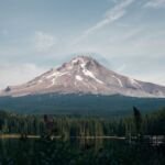 Zigzag Mountain Trail #775
24.4 mi
8,421 ft
Very hard
 Cast Creek Trail #773
10.4 mi
3,138 ft
Very hard
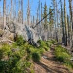 Devils Tie Trail #767
0.6 mi
345 ft
Easy
Horseshoe Ridge Trail #774
9.2 mi
3,259 ft
Very hard
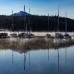 Burnt Lake Trail #772
9 mi
1,984 ft
Hard
 West Zigzag Trail #789
4.6 mi
1,607 ft
Hard
 Lost Creek Nature Trail #776
0.6 mi
31 ft
Easy
 French’s Dome Trail #776
0.6 mi
31 ft
Easy
 Paradise Park Trail #778
13.8 mi
3,574 ft
Very hard
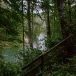 Sandy River Trail #770
6.6 mi
690 ft
Moderate