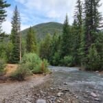
The first stretch of Horseshoe Ridge Trail #774 crosses the nearly level ground of Old Maid Flat, but the trail’s goal is the alpine ridgeline of Zigzag Mountain in the Mt. Hood Wilderness. It begins at the shared Cast Creek, Horseshoe Ridge and Sandy River Trailhead by Riley Horse Camp, off Lolo Pass Road north of Zigzag.
Lost Creek has no bridge, and a few shallow stream crossings follow. After that the trail climbs steadily for 3.9 miles up Horseshoe Ridge, ending where it breaks out of the trees onto Zigzag Mountain at Trail #775. Combine it with Cast Creek Trail #773 and Zigzag Mountain Trail #775 for a long loop.
Trail map & elevation
- Trail class
- Class 3 of 5
- Typical grade
- 12-20%
- Surface
- Native material
- Tread width
- 18-24 inches
- Ranger district
- Zigzag
Connects to: Sandy River Trail #770, Zigzag Mountain Trail #775
Line, length and trail class: U.S. Forest Service trail data. Elevation: USGS 3D Elevation Program. Difficulty is our estimate for hiking it out and back (once around for a loop), from distance and total climb. Lines can be off by a few hundred feet; carry a real map and check the official page for closures.
Getting there
- Accessed from Cast Creek, Horseshoe Ridge, Sandy River Trailhead located within Riley Horse Campground on Forest Road #1825-380.
From Sandy
- Follow U.S. Hwy 26 for 17.5 miles to Zigzag.
- Turn left (north) at Lolo Pass Road (Forest Road 18) and follow it for 4 miles.
- Turn right at Muddy Fork Road (Forest Road 1825) and continue for 0.7 mile.
- Take the first right onto Muddy Fork Road (Forest Road 1825) and travel 0.5 mile to another right turn at Forest Road 1825-380.
- Travel another 0.1 mile before turning right into Riley Campground.
- Continue through the campground to the parking area.
- The trail starts on the southwest side of Forest Road 1825-380, 150 feet from the intersection with Forest Road 1825, and 500 feet before the entrance into Riley Campground.
From the Forest Service
Rules and restrictions
Wilderness restrictions apply in Mt Hood Wilderness.
Passes and permits
A valid Recreation Pass is required at Cast Creek, Horseshoe Ridge, Sandy River trailhead from May 1 to October 31.
Trails nearby
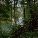 Sandy River Trail #770
6.6 mi round trip
690 ft
Moderate
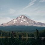 Zigzag Mountain Trail #775
24.4 mi round trip
8,421 ft
Very hard
 Cast Creek Trail #773
10.4 mi round trip
3,138 ft
Very hard
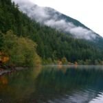 Cast Lake Trail #796
1 mi round trip
218 ft
Easy
 West Zigzag Trail #789
4.6 mi round trip
1,607 ft
Hard
 Devils Tie Trail #767
0.6 mi round trip
345 ft
Easy
 Lost Creek Nature Trail #776
0.6 mi round trip
31 ft
Easy
 French’s Dome Trail #776
0.6 mi round trip
31 ft
Easy
 Burnt Lake Trail #772
9 mi round trip
1,984 ft
Hard
 Castle Canyon Trail #765
1.6 mi round trip
922 ft
Moderate