
In the Government Camp trail system, Enid Lake Trail #692A connects the Crosstown Trail #755 with the Glacier View Trail #692B. Because it ties two other routes together, it is a useful piece for building a longer outing through the network.
Winter is when this trail really shines. Cross-country skiers and snowshoers make it one of the popular choices in the area once snow settles in. Look up the Government Camp trail system map to see how this piece fits with its neighbors.
Trail map & elevation
- Trail class
- Class 2 of 5
- Typical grade
- 12-20%
- Surface
- Snow
- Tread width
- 18-24 inches
- Ranger district
- Zigzag
Connects to: Pioneer Bridle Trail #795, Crosstown Trail #755
Line, length and trail class: U.S. Forest Service trail data. Elevation: USGS 3D Elevation Program. Difficulty is our estimate for hiking it out and back (once around for a loop), from distance and total climb. Lines can be off by a few hundred feet; carry a real map and check the official page for closures.
From the Forest Service
Ranger office
Zigzag Ranger District
Address: 70220 E Highway 26 Zigzag, OR 97049
Phone: 503-622-3191
Hours: Monday to Friday, 8 a.m. to 4 p.m. Closed 12 to 1 for lunch. (Closed on federal holidays)
Trails nearby
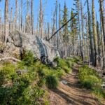 Pioneer Bridle Trail #795
16 mi round trip
2,488 ft
Very hard
 Crosstown Trail #755
5.4 mi round trip
618 ft
Moderate
 Maggie’s Trail #753
0.8 mi round trip
80 ft
Easy
Glacier View Trail #692B
1.8 mi round trip
175 ft
 Lucy’s Trail #752
0.4 mi round trip
21 ft
Easy
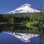 Mirror Lake Trail #664
7 mi round trip
1,695 ft
Hard
 Summit Trail #691
4 mi round trip
430 ft
Moderate
Skiway Trail #755B
1.4 mi round trip
258 ft
Easy
 Little Zigzag Falls Trail #795C
1.2 mi round trip
311 ft
Easy
 Hidden Lake Trail #779
8.4 mi round trip
2,694 ft
Very hard
 Laurel Hill Chute Trail #759A
1 mi round trip
356 ft
Easy
Wally’s Tie Trail #755A
0.6 mi round trip
13 ft
Easy