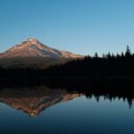
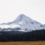
Circling Lost Lake for 3.1 miles, Lakeshore Trail #656 is an easy loop. It begins where Lost Lake Viewpoint Road ends, just west of the store on the lake’s north shore, and much of it is raised boardwalk through old-growth cedar, Douglas fir and hemlock, with Mount Hood in view.
From the start, a 0.2-mile stretch heading west doubles as a self-guided nature walk. Going south from the store parking lot, the 1.2 miles to the far end of the lake are barrier-free, good for visitors with limited mobility. Watch for beaver activity at the inlet. Reach Lost Lake from Hood River by Highway 35, the Dee Highway and Forest Road 13.
Trail map & elevation
- Trail class
- Class 4 of 5
- Typical grade
- 0-5%
- Surface
- Native material
- Tread width
- 24-36 inches
- Ranger district
- Hood River
Connects to: Lost Lake Butte Trail #616, Old Growth Trail #657
Line, length and trail class: U.S. Forest Service trail data. Elevation: USGS 3D Elevation Program. Difficulty is our estimate for hiking it out and back (once around for a loop), from distance and total climb. Lines can be off by a few hundred feet; carry a real map and check the official page for closures.
Things to do
- Outdoor Science and Learning
- Fishing
- Picnicking
- Viewing
Getting there
From Hood River
- travel south on Hwy 35 ~14 miles to Woodworth Rd. Turn right (west) on Woodworth Road and travel 2 miles to Dee Highway.
- Turn right (northwest) on Dee Highway and travel approximately 3.6 miles to the Dee Mill site.
- Turn left and follow signs to Lost Lake (Forest Road 13).
- Follow Lost Lake Road 13 miles to Lost Lake Campground.
- The trail starts west of the store at the end of Lost Lake Viewpoint Road.
From the Forest Service
All fees
Lost Lake Campground and Resort operated by a concessionaire. Please check with Lost Lake Resort for information on day use and camping fees.
Passes and permits
Lost Lake Resort does not accept the Northwest Forest Pass or Interagency Pass.