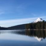
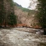
Blue Box Trail #483 is a well-used way to walk to Clear Lake. From the Frog Lake trailhead at Wapinitia Pass on US 26 (about 3,920 feet), cross the highway to the Pacific Crest Trail #2000, follow it roughly 300 feet, and turn left onto Blue Box.
The path climbs on smooth tread among old-growth Douglas fir and hemlock, crosses two forest roads, and tops out around 4,600 feet near the edge of a clearcut. The final 0.5 mile descends to Clear Lake at 3,560 feet, with user paths branching to dispersed campsites. From the PCT junction it is about 3.6 miles.
Trail map & elevation
- Trail class
- Class 2 of 5
- Typical grade
- 12-20%
- Surface
- Native material
- Tread width
- 18-24 inches
- Ranger district
- Hood River
Line, length and trail class: U.S. Forest Service trail data. Elevation: USGS 3D Elevation Program. Difficulty is our estimate for hiking it out and back (once around for a loop), from distance and total climb. Lines can be off by a few hundred feet; carry a real map and check the official page for closures.
Getting there
From Hood River, OR
- Travel 35 miles south on Oregon Hwy 35 to US Hwy 26.
- Follow US Hwy 26 south to Frog Lake Sno-Park at Wapinitia Pass (Forest Road 2610) (approximately 300’ south of milepost 62).
- Turn left (east) into the Frog Lake Sno-Park parking area.
From Portland, OR
- Follow US Hwy 26 35 miles southeast of Sandy to Frog Lake Sno-Park at Wapinitia Pass (Forest Road 2610) (approximately 300’ south of milepost 62).
- Turn left (east) into the Frog Lake Sno-Park parking area.
From the Forest Service
Passes and permits
The Annual Northwest Forest Pass is required at Frog Lake Sno-Park/Trailhead from May 1 through October 31. A Sno-Park Permit is required from November 1 through April 30.