
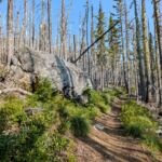
Near Eureka Peak, within a few miles of the Trillium Lake and Still Creek campgrounds, Eureka Peak Trail #671 is a short single-track trail aimed mostly at experienced mountain bikers. Nearly the whole route runs downhill, from Veda-Eureka Saddle on Forest Road 2613 (Sherar Burn Road) to Forest Road 2612 (Still Creek Road).
The grade ranges from moderate to steep as the trail drops from young lodgepole pine into older stands of Douglas fir, with a single water crossing near the bottom. Combine it with the eastern stretches of Still Creek Road and Sherar Burn Road for a loop. Both ends are reached from US Hwy 26 just east of Government Camp by way of Still Creek Campground Road.
Trail map & elevation
- Trail class
- Class 2 of 5
- Typical grade
- 12-20%
- Surface
- Native material
- Tread width
- 18-24 inches
- Ranger district
- Zigzag
Connects to: Sherar Burn Road Trail #2613
Line, length and trail class: U.S. Forest Service trail data. Elevation: USGS 3D Elevation Program. Difficulty is our estimate for hiking it out and back (once around for a loop), from distance and total climb. Lines can be off by a few hundred feet; carry a real map and check the official page for closures.
Getting there
From Portland, OR to the SOUTH end of trail
- Take US Hwy 26 29.5 miles east of Sandy.
- At 0.5 mile east of Government Camp turn right (south) onto the Still Creek Campground Road.
- Follow this road south through the campground 1.1 miles and turn right (westward) onto Chimney Rock Drive.
- Continue on this road for 0.5 mile until it reaches an intersection.
- Cross the intersection and continue on Sherar Burn Road (Forest Road 2613).
- Follow Sherar Burn Road (Forest Road 2613) for 2 miles and park at the trailhead at Veda-Eureka Saddle.
- The trail is on the northwest side of the road.
From Portland, OR to the NORTH end of the trail
- Follow the above directions to the intersection with Sherar Burn Road (Forest Road 2613).
- Take the sharp right onto Still Creek Road (Forest Road 2612) and travel 2.5 miles to the trailhead.
- The trail is on the south side of the road.
From the Forest Service
Good to know
Trail access is impacted by a recreational gate closure from December 1 to April 1 annually.
Trails nearby
 Sherar Burn Road Trail #2613
18 mi round trip
2,557 ft
 Still Creek Road Trail
24.8 mi round trip
2,653 ft
 Trillium Lake Loop Trail #761
1.8 mi loop
11 ft
Easy
 Veda Lake Trail #673
2.4 mi round trip
889 ft
Moderate
 Dry Fir Trail #674A
5.8 mi round trip
963 ft
Hard
 Mirror Lake Trail #664
7 mi round trip
1,695 ft
Hard
 Summit Trail #691
4 mi round trip
430 ft
Moderate
 Snowbunny Trail
3.6 mi round trip
567 ft
 Glacier View Trail #692B
1.8 mi round trip
175 ft
Lucy’s Trail #752
0.4 mi round trip
21 ft
Easy
 Jackpot Meadows Trail #492
9 mi round trip
1,830 ft
Hard