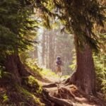
Riders and hikers both use this 1.3-mile link in the Gibson Prairie Trail System. It joins Gibson Prairie Horse Camp with Gibson Prairie Trailhead, so either lot works as a starting point for horse trailers heading out to the rest of the network.
From Government Camp, drive 2 miles east on Highway 26, then 13.5 miles north on Highway 35. Turn east on Forest Road 44 (Brooks Meadow Road) for 5.7 miles, then follow Forest Road 17 (Surveyors Ridge) north for 5.6 miles. Volunteers with the Back Country Horsemen of Oregon help maintain the trail as part of their work keeping pack and saddle stock in the backcountry.
Trail map & elevation
- Trail class
- Class 2 of 5
- Typical grade
- 5-8%
- Surface
- Native material
- Ranger district
- Hood River
Connects to: Thoroughbred Trail #427, Mustang Trail #422
Line, length and trail class: U.S. Forest Service trail data. Elevation: USGS 3D Elevation Program. Difficulty is our estimate for hiking it out and back (once around for a loop), from distance and total climb. Lines can be off by a few hundred feet; carry a real map and check the official page for closures.
Getting there
From Government Camp, OR
- take US Hwy 26 east for 2 miles then head north on OR Highway 35 for 13.5 miles.
- Turn right (east) on Forest Service Road 44 (Brooks Meadow Road) and follow for 5.7 miles.
- Go left (north) on Forest Road 17 (Surveyors Ridge) and follow 5.6 miles to trailhead.
From the Forest Service
Ranger office
Barlow Ranger District
Address: 780 NE Court St Dufur, OR 97021
Phone: 541-467-5100
Hours: Monday to Friday, 8 a.m. to 3 p.m. Closed 12 to 1 for lunch. (Closed on federal holidays)