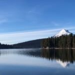
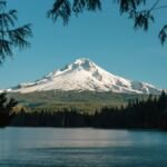
Hikers bound for Anvil Lake cross Black Wolf Meadows on this trail, where wildflowers grow thick and huckleberries turn up all over when they ripen. It runs from Forest Road 5800-160 (4,160 feet) to Forest Road 5820 (3,960 feet) close to the lake. Anglers will find good fishing at Anvil Lake, and there are dispersed campsites along the route.
Expect a few wet spots, and go easy on the meadow. From Estacada, follow Highway 224 east 25 miles, then Forest Road 57 for 7.2 miles and Forest Road 58 east for 6.3 miles. Turn right on 5800-160 and go about half a mile to the trailhead, which is on the left.
Trail map & elevation
- Trail class
- Class 1 of 5
- Typical grade
- 12-20%
- Surface
- Native material
- Tread width
- 18-24 inches
- Ranger district
- Clackamas River
Line, length and trail class: U.S. Forest Service trail data. Elevation: USGS 3D Elevation Program. Difficulty is our estimate for hiking it out and back (once around for a loop), from distance and total climb. Lines can be off by a few hundred feet; carry a real map and check the official page for closures.
Getting there
From Estacada
- Follow OR Hwy 224 east and travel 25 miles to Forest Road 57.
- Turn left onto Forest Road 57 and follow it for 7.2 miles to Forest Road 58.
- Turn left (east) onto Forest Road 58 and travel 6.3 miles to Forest Road 5800-160.
- Turn right (east) on 5800-160 and travel approximately 0.5 mile to the trailhead on the left.