
Deep forest surrounds Green Point Ridge Trail #418, a 2.5-mile connector in the Mark O. Hatfield Wilderness between Gorton Creek Trail #408 and Wyeth Trail #411. Most of it runs fairly level along the crest of Green Point Ridge, with the steeper climbing at the north end.
From the south, start at Rainy Lake Campground on Dead Point Road, reached from Hood River via Dee Highway. Take Rainy Lake Trail #423A beyond the lake to North Lake Trail #423 and go west about 0.5 mile to the three-way junction where #418 begins. It follows the ridge north 1.5 miles to Plateau Cutoff Trail #412, then 1 mile more to Wyeth Trail #411, 4.9 miles above Wyeth Campground.
Trail map & elevation
- Trail class
- Class 2 of 5
- Typical grade
- 12-20%
- Surface
- Native material
- Tread width
- 18-24 inches
- Ranger district
- Hood River
Connects to: Plateau Cutoff Trail #412, North Lake Trail #423, Wyeth Trail #411, Gorton Creek Trail #408
More about the Mark O. Hatfield Wilderness and its trails →
Line, length and trail class: U.S. Forest Service trail data. Elevation: USGS 3D Elevation Program. Difficulty is our estimate for hiking it out and back (once around for a loop), from distance and total climb. Lines can be off by a few hundred feet; carry a real map and check the official page for closures.
Getting there
From Hood River, OR
- travel south on OR Hwy 281 Dee Highway 11 miles to Lost Lake Road, at Dee.
- Take the right fork here and cross the East Fork of the Hood River.
- Turn right again and go 1.2 miles up Punchbowl Road until it crosses the West Fork of the Hood River.
- The road becomes Dead Point Road (Forest Road 2820) here.
- Follow Dead Point Road 11 miles until you get to Rainy Lake Campground and Trailhead.
- From Rainy Lake Campground take the Rainy Lake Trail #423A north past Rainy Lake to the junction with the North Lake Trail #423.
- Go left heading west on North Lake Trail for about 0.5 miles.
- At a three-way junction you will find the Green Point Ridge Trail #418 on your right.
From the Forest Service
Rules and restrictions
Wilderness restrictions apply.
Ranger office
Hood River Ranger District
- Phone
- 541-352-6002
- Hours
- Monday to Friday, 8 a.m. to 3 p.m. Closed 12 to 1 for lunch. (Closed on federal holidays)
Trails nearby
 Plateau Cutoff Trail #412
1 mi round trip
101 ft
Easy
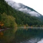 North Lake Trail #423
2.8 mi round trip
695 ft
Moderate
Wyeth Trail #411
14.2 mi round trip
5,330 ft
Very hard
 Gorton Creek Trail #408
17.8 mi round trip
4,649 ft
Very hard
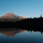 Rainy Lake Trail #423A
1.2 mi round trip
119 ft
Easy
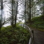 Rainy Wahtum Trail #409
10 mi round trip
1,442 ft
Hard
 Herman Cutoff Trail #410
4.4 mi round trip
1,523 ft
Hard
Nick Eaton Trail #447
8.2 mi round trip
3,675 ft
Very hard
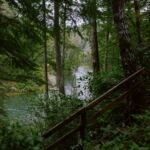 Herman Creek Trail #406
20.6 mi round trip
5,640 ft
Very hard
 Mt. Defiance Trail #413
13.2 mi round trip
5,780 ft
Very hard
Warren Lake Trail
0.8 mi round trip
47 ft
Easy
 Mitchell Point Trail #417
4 mi round trip
1,222 ft
Moderate