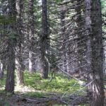
If Warren Lake in the Mark O. Hatfield Wilderness is your goal, this trail is the shortest way in. It sets out at about 3,820 feet on Forest Road 2821, follows an old roadbed north through a clearcut, crosses Forest Road 2821-630 near traces of a former trailhead and camp, and meets Mitchell Point Trail #417 after 0.4 mile.
Turn left on #417 and walk 0.3 mile to the lake at 3,740 feet, about 0.7 mile from your car in all. Several established campsites sit by the water. The drive heads south from Hood River on the Dee Highway, then up Dead Point Road (Forest Road 2820).
Trail map & elevation
- Trail class
- Class 2 of 5
- Typical grade
- 12-20%
- Surface
- Native material
- Tread width
- 18-24 inches
- Ranger district
- Hood River
Connects to: Mitchell Point Trail #417
More about the Mark O. Hatfield Wilderness and its trails →
Line, length and trail class: U.S. Forest Service trail data. Elevation: USGS 3D Elevation Program. Difficulty is our estimate for hiking it out and back (once around for a loop), from distance and total climb. Lines can be off by a few hundred feet; carry a real map and check the official page for closures.
Getting there
- From Hood River, travel south on OR Hwy 28 Dee Highway 11 miles to the Lost Lake turn-off.
- Bear right here and cross the East Fork of the Hood River.
- Turn right again and go 1.2 miles up Punchbowl Rd until it crosses the West Fork of the Hood River.
- Go around the bend and past Forest Road 2810.
- After another bend you will be on Forest Road 2820 (Dead Point Road).
- Stay on Forest Road 2820 for about 8 miles until you get to the T-intersection with Forest Road 2821.
- Go right staying on Forest Road 2821 about 2.5 miles to a wide turnaround below a locked gate at about elevation 3800 feet.
- Look for a blocked road heading north on the northwest corner of the parking area.
From the Forest Service
Rules and restrictions
Wilderness restrictions apply
Season details
Usually accessible in May
Trails nearby
 Mitchell Point Trail #417
4 mi round trip
1,222 ft
Moderate
 Mt. Defiance Trail #413
13.2 mi round trip
5,780 ft
Very hard
 Bear Lake Trail #413A
1.4 mi round trip
276 ft
Easy
 Wyeth Trail #411
14.2 mi round trip
5,330 ft
Very hard
 Green Point Ridge Trail #418
5 mi round trip
809 ft
Moderate
 North Lake Trail #423
2.8 mi round trip
695 ft
Moderate