
Flag Mountain Trail #766 is a lower-elevation ridge walk off US 26 with a few good looks at Mt. Hood, and dogwood and rhododendron flower here in abundance. The west trailhead is reached by Forest Road 20 near milepost 44, with parking just off Forest Road 20E. The east end sits along Forest Road 2632-160.
From the northwest end, expect a steep climb of nearly half a mile to reach the ridge. After that the grade eases, though the path still rises and dips. Mountain bikers will find narrow singletrack, with the first pitch too steep for many riders and the ridge a real challenge.
Trail map & elevation
- Trail class
- Class 2 of 5
- Typical grade
- 12-20%
- Surface
- Native material
- Tread width
- 18-24 inches
- Ranger district
- Zigzag
Line, length and trail class: U.S. Forest Service trail data. Elevation: USGS 3D Elevation Program. Difficulty is our estimate for hiking it out and back (once around for a loop), from distance and total climb. Lines can be off by a few hundred feet; carry a real map and check the official page for closures.
Getting there
From Portland, OR to the WEST end of the trail
- Follow U.S. Hwy 26 19.5 miles east of Sandy.
- Turn right on Forest Road 20 (0.4 mile east of milepost 44) and follow it to where it veers right/left and go left.
- Travel approximately 0.6 mile to Forest Road 20E, and turn left.
- Travel another 150 feet and park in the trailhead parking lot on your left.
- Cross the road to get to the trailhead.
From Portland OR to the EAST end of the trail
- Follow U.S. Hwy 26 22.4 miles east of Sandy to Forest Road 2632 (0.2 mile east of milepost 47).
- Turn right (south) and travel 0.3 mile until you reach a bridge with a current closure for vehicle passage.
- Park along the shoulder before the bridge and hike the rest of the way (0.4 mile) and turn right onto Forest Road 2632-160.
- Follow Forest Road 2632-160 for 0.6 mile to a small, gravel parking area.
- The trailhead is on the right (north) side of the road.
Trails nearby
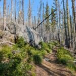 Pioneer Bridle Trail #795
16 mi
2,488 ft
Very hard
 Cool Creek Trail #794
6 mi
3,375 ft
Very hard
 Still Creek Trail #780
3.2 mi
693 ft
Moderate
 Hunchback Trail #793
18 mi
7,653 ft
Very hard
 Castle Canyon Trail #765
1.6 mi
922 ft
Moderate
Green Canyon Way Trail #793A
6.4 mi
3,698 ft
Very hard
 West Zigzag Trail #789
4.6 mi
1,607 ft
Hard
 Old Salmon River Trail #742A
3.8 mi
280 ft
Easy
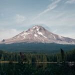 Zigzag Mountain Trail #775
24.4 mi
8,421 ft
Very hard
 Bonanza Trail #786
9.4 mi
3,662 ft
Very hard