
Benson Spur Trail #405C is a short, easy link over the northern end of the Benson Plateau in the Mark O. Hatfield Wilderness, joining Ruckel Creek Trail #405 to the Pacific Crest Trail #2000. The plateau has several scenic meadows and dispersed campsites, and this spur is a key piece of the route between the high country and the Columbia River Gorge.
To reach it, follow Ruckel Creek Trail #405 for 4.8 miles east of its junction with Gorge Trail #400. The approach starts near Eagle Creek Campground at I-84 exit 41, where Gorge Trail #400 and the old Columbia River Highway lead to the Ruckel Creek trailhead.
Trail map & elevation
- Trail class
- Class 2 of 5
- Typical grade
- 12-20%
- Surface
- Native material
- Tread width
- 18-24 inches
- Ranger district
- Hood River
Connects to: Ruckel Creek Trail #405
More about the Mark O. Hatfield Wilderness and its trails →
Line, length and trail class: U.S. Forest Service trail data. Elevation: USGS 3D Elevation Program. Difficulty is our estimate for hiking it out and back (once around for a loop), from distance and total climb. Lines can be off by a few hundred feet; carry a real map and check the official page for closures.
Getting there
- Access via Ruckel Creek Trail #405.
From Portland, OR
- Take I-84 east to Eagle Creek exit # 41 and follow signs to the Eagle Creek Campground.
From Hood River, OR
- Take I-84 west to Bonneville Dam exit 40.
- Drive under the freeway and join eastbound traffic.
- After 1 mile take Eagle Creek exit # 41 and follow signs to Eagle Creek Campground.
- To Ruckel Creek Trail:
- From the Eagle Creek parking lot near the campground.
- Walk northeast up the paved road towards the campground the Gorge Trail #400.
- Take this trail up the bluff and along the north section of the campground.
- Keep left and descend to a clearing and a junction with the Old Columbia River Highway.
- Take a right on the old highway and follow to Ruckel Creek and the trailhead.
From the Forest Service
Rules and restrictions
Wilderness restrictions apply.
Trails nearby
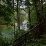 Ruckel Creek Trail #405
3.8 mi
619 ft
Moderate
 Eagle Benson Trail #434
5.4 mi
3,390 ft
Hard
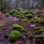 Eagle Creek Trail #440 (Columbia River Gorge)
18 mi
5,148 ft
Very hard
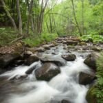 Casey Creek Trail #476
3.6 mi
2,428 ft
Hard
Herman Creek Trail #406
16 mi
4,520 ft
Very hard
 Herman Cutoff Trail #410
4.4 mi
1,523 ft
Hard