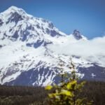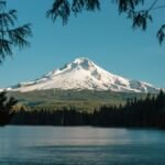
Round Lake Trail #565 is a short, easy walk to Round Lake that also circles the shoreline. It starts at about 3,520 feet, and there are dispersed campsites along the lake’s east end.
Getting there takes some navigating. Follow Highway 224 through Estacada until it becomes Forest Road 46, stay on it for 27 miles, then work through a chain of smaller forest roads: 6350, 6355, a couple of spurs and finally 6370. Park on the right by the old sign for Round Lake Campground, where a Round Lake sign marks the trail.
Trail map & elevation
- Trail class
- Class 2 of 5
- Typical grade
- 12-20%
- Surface
- Native material
- Tread width
- 18-24 inches
- Ranger district
- Clackamas River
Line, length and trail class: U.S. Forest Service trail data. Elevation: USGS 3D Elevation Program. Difficulty is our estimate for hiking it out and back (once around for a loop), from distance and total climb. Lines can be off by a few hundred feet; carry a real map and check the official page for closures.
Getting there
From Portland, OR
- Travel east on US Hwy 26 to Sandy.
- Turn right (southwest) on OR Hwy 211 and travel 6.1 miles to OR Hwy 224.
- Turn left (southeast) on Hwy 224 to Estacada and Hwy 224 for 26 1/4 miles becomes Forest Service Road 46.
- Continue on FS 46 for 27 miles to Forest Road 6350.
- Turn right onto Forest Road 6350 and travel 4.9 miles to Forest Road 6355.
- Take the left fork onto Forest Road 6355 and follow it for .3 miles to 6355-150 and take a left.
- Follow 6355-150 for .8 miles to a junction, take a sharp right onto the 220 spur and continue 2.1 miles to 6370.
- Turn right and follow 6370 3.5 miles to the trailhead on the right.
- Parking is near the old Round Lake Campground sign.