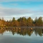
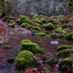
Old-growth forest and frequent views of the Clackamas River define Riverside Trail #723, a designated National Recreation Trail running between Rainbow Campground and Riverside Campground. The Rainbow end is just off Forest Road 46, a short way from where it leaves Highway 224 at milepost 50.
From Rainbow, the path follows the Oak Grove Fork to where it joins the Clackamas, with the first river view at 0.5 mile. About 1.6 miles farther there’s a nice beach, and just beyond, a spur from Forest Road 4600-039 offers a shorter start. A grove of huge old-growth trees comes 1.1 miles later, and Riverside Campground is 0.4 mile past that. The trail is mostly level, with occasional changes in grade.
Trail map & elevation
- Trail class
- Class 3 of 5
- Typical grade
- 12-20%
- Surface
- Native material
- Tread width
- 18-24 inches
- Ranger district
- Clackamas River
Line, length and trail class: U.S. Forest Service trail data. Elevation: USGS 3D Elevation Program. Difficulty is our estimate for hiking it out and back (once around for a loop), from distance and total climb. Lines can be off by a few hundred feet; carry a real map and check the official page for closures.
Getting there
From Portland, OR
- Travel east on US Hwy 26 to Sandy.
- Turn right (southwest) on OR Hwy 211 and travel 6.1 miles to OR Hwy 224.
- Turn left (southeast) on OR Hwy 224 and travel 30.6 miles to Clackamas River Hwy (Forest Road 46) (at milepost 50).
- Travel 0.3 mile to Rainbow Campground Trailhead sign.
- Turn right into the trailhead parking lot.
- The trail starts 0.1 mile from the road.
From the Forest Service
Rules and restrictions
Horses and bikes are prohibited.